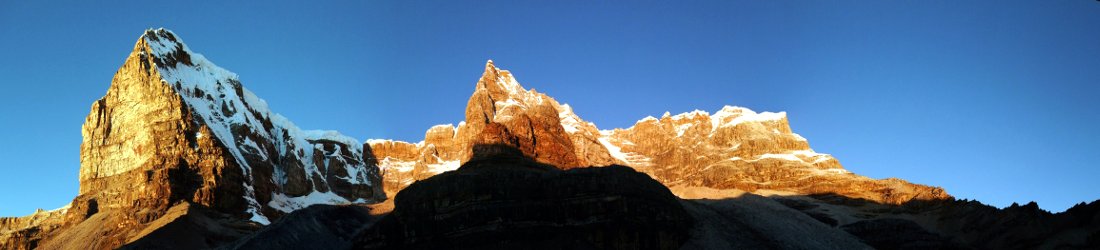

I’ve looked at Waun Fach from both sides now, from up and down, and still somehow… I really don’t know Waun Fach at all.
Joni Mitchell didn’t say
I’ve made several visits to the Black Mountains over the years, but I had never climbed its highest peak, Waun Fach (811m), so this year I decided to put this omission behind me by climbing it twice.
Now I know what some of you will be thinking: Waun Fach? Is that the name of a mountain or a Welsh swear word? It sounds like the sort of thing Gareth Bale used to mouth to the camera after spooning a free kick over the crossbar.
I know it sounds a bit rude, but I can promise you that it really is the name of a mountain (there is also a peak in the Black Mountains called Lord Hereford’s Knob, but that’s a story for another time). However, if you’re familiar with the Welsh language (or you’ve been following this blog and you’re recalling an earlier post) then you may also be wondering, how can Waun Fach be the highest peak in the Black Mountains?

The name ‘Waun Fach’ translates from Welsh as ‘Little Moorland’. Most Welsh mountains called ‘Fach’ therefore have a nearby peak called ‘Fawr’ (‘Big’) that is slightly higher. It follows that there should be a Waun Fawr that is the highest peak in the Black Mountains. But there isn’t. Moreover, Waun Fach can hardly be described as a peak at all: it’s more of a big, boggy plateau with a summit cairn placed seemingly at random on its surface. For visitors to Kinder Scout in the Peak District (sometimes referred to simply as ‘The Peak’ by people with no understanding of irony), this will sound familiar.
Since moving to the Cotswolds, the Black Mountains are now my nearest high hills. They are essentially composed of four broad, north-to-south ridges on the border between the Welsh counties of Brecknockshire and Monmouthshire, and the English county of Herefordshire. The ridges contain two county tops (although Waun Fach, which lies in Brecknockshire, isn’t one of them). At the northern end they form a steep escarpment, while to the south they are divided by deep valleys.
Waun Fach is more easily accessed from the west, where there is a major road running up the Rhiangoll Valley and a selection of well-trodden footpaths up to the top. Being a bit of an idiot, however, I decided to do it from the east side first, where access is via a single-track road deep in forest, and footpaths – as will be seen – are, well, not always available.

Waun Fach from the east
My first visit was back in April when the grass was green and rain was still a thing. Those were the days when two months without rain in Britain seemed no more likely than aliens landing in Parliament Square.
There may be no Waun Fawr, but Waun Fach does have a twin about 1.8km to the south-east called Pen y Gadair Fawr (800m) that is far more prominent and ‘peak-like’, albeit a few metres lower. My plan was to park in the Mynydd Du Forest, deep within the Grwyne Fawr Valley. I would climb up through the forest onto the western ridge, then follow the ridge to its northernmost extent, over Pen y Gadair Fawr and Waun Fach. It happens that the northernmost extent is a moorland escarpment at the head of the Grwyne Fawr Valley; I could therefore double back and descend the valley to my car.
The Mynydd Du Forest wasn’t easy to get to. I drove for 16km along a narrow road with few passing places: the sort of road where you pray you won’t meet anyone coming the way, or there would be a Mexican stand off until someone agreed to reverse 100m between hawthorn hedges to the nearest available passing place. The valley was deep and dark, and enclosed by pine forest. By a miracle I reached the substantial car park at the end of the public road without having to reverse.

The Ordnance Survey map marked a maze of forestry roads on the steep hillside west of the car park. OpenMaps marked a further network of trails, but some of these must only have been trails at some point in the dim and distant past. Others were merely cuttings where trees had once been hewn, but had become quite overgrown. In other places trees had fallen across, rendering them impassable. I had been warned of this via a review of the car park on Google Maps. I also used the satellite view on my OS app to confirm whether a trail look liked it still existed. Before leaving home, I used a combination of the OS map, OpenMaps and the satellite view to plot a likely route through the forest and up to the moorland above. To save you the bother of doing this yourself, I’ve provided a link to my GPX at the bottom of this post (that is, if you’re still stupid enough to follow my footsteps after reading the description below).
Things started OK as I followed an overgrown shelf that must once have been a forestry road that had long since been left to go wild. After about 400m I turned off this to take a direct route straight up the hillside, through one of the forest cuttings I had identified on the OS map. This cutting came in three sections, each intersected by a forestry road. The first section was ludicrously steep, straight through the pine plantation with no clear trail, though there was evidence that others had also used it. Towards the top I had to take a wide diversion round a giant fallen tree. The second section was much less steep, with a clear trail through the trees to bisect the next parallel road. The third section was also not as steep, but potentially the most awkward. There were many fallen trees, including one that I had to crawl underneath. When squeezing between tree trunks, I had to be wary of protruding branches at head height with the potential to take an eye out and leave it skewered like a kebab.
By the time I reached the third forestry road, about half of the vertical ascent was behind me. From here I could identify a route to the top of the forest by keeping to roads on long zigzags. I climbed above a quarry and emerged into heather clad moorland just north of the 658m summit of Pen Twn Mawr. It had taken me just over an hour to mix and match a route through the forest, but I had finally escaped.

I was now on a broad, heather-clad ridge. I trudged through the heather to reach the summit cairn of Pen Twyn Mawr. This wasn’t much of a peak, but it was a good viewpoint looking south and south-east to Sugar Loaf and the Skirrid, respectively. Both of these peaks were lower but better-known that the one I stood on. Sugar Loaf is a distinctive, isolated peak that dominates the town of Abergavenny nestling beneath it. It can also be seen clearly from the A40. The Skirrid had been occupying my thoughts recently on account of a slightly odd mystery concerning its shape (the subject of a previous post).
To the west, a parallel ridge containing the summit of Pen Allt Mawr looked high and far away. In reality, it was barely 3km away and only 60m higher than where I stood. I followed a grassy trail along the ridge to Pen y Gadair Fawr. The fringes of the forest sat below the ridge to my right, while to my left was a distant view across hillsides to Pen y Fan, 23km away.
The summit of Pen y Gadair Fawr was perched on top of a flat, grassy platform, almost like the remains of an iron age hill fort. I could see one lone figure walking up to the top while I was still some distance away. But it wasn’t until I reached the summit myself at midday that I met other people, the first since leaving the car park two hours earlier. A proper 2m-wide stone trail, complete with drainage channels, led all the way to Waun Fach. I saw many people walking along it as I sat beneath the summit eating my lunch. I looked down towards the Grwyne Fawr Reservoir where I had camped on a backpacking trip in 2010.

The walk to Waun Fach would have been much boggier had it not been for the incongruous manmade trail. Waun Fach isn’t really a summit at all, but a giant peat bog. Any point on its surface could have been chosen for the summit cairn. The trail snaked across to the plateau’s northern end, where the cairn overlooks the lowlands to the north. This location may or may not be the highest point, but the view is better there than the middle of the plateau.
A trio of hikers asked me to take their photo beside the cairn. I obliged them and returned their camera, only to see them wander off without offering to return the favour. I didn’t really mind, as a selfie was quite sufficient, but it struck me as a bit odd. It’s a bit like waving to get someone’s attention then buggering off as soon as they acknowledge you.
The next part of the walk was along the edge of the escarpment, looking north to the lowlands of the Wye Valley on the Welsh border. It was surprisingly busy. Cyclists raced down the hill in my direction. Luckily I saw them and stayed out of their way. Runners legged it past me and I overtook some groups of my own. The terrain was awkward to begin with, as multiple rutted furrows meant that I had to watch where I put my feet. These ruts petered out, and eventually the route joined soft, short grass that was pleasant to walk across.

The wind was on my back, and I didn’t notice how strong it was until I left the escarpment and turned south to follow the head of the valley down to the Grwyne Fawr Reservoir. Now its full force blasted into my face. There was nowhere to shelter as the trail led gently down between cheeks of rolling hillside, and it was quite unpleasant. After a few minutes I reached a little side valley where I could sit in a sheltered spot in the lee of a bank and eat the rest of my lunch.
When I resumed the walk there was a nice view beyond the reservoir to the triangular top of Chwarel y Fan. I had climbed up to this point during my backpacking trip in 2010 to find myself on a ridge with no obvious top. I had no idea that I was actually crossing the highest point in Monmouthshire. I returned there with Edita in 2024 to tick it off during our quest to complete the Welsh county tops.
This time I kept to the valley. At the southern end of the reservoir I passed the impressive stone dam holding back its waters. Beyond this, a pleasant trail kept high above the valley to reach the top of the forest. I descended through the forest on a horrible stony track that would have twisted all the legs of a centipede. I arrived back at the car park in the Mynydd Du Forest at 3 o’clock.

Waun Fach from the west
My second visit came in late August, by which time it hadn’t rained for over two months and the grass in my part of the country was beginning to resemble the Serengeti, only much shorter (and without the vast herds of wildebeest). In Britain, a few weeks without rain is so unusual that it is considered a national emergency. The previous week, everyone in Britain had received an urgent text message from the government instructing them not to have barbecues. Down the road from me in Cheltenham, a community cricket team had been banned from their local club for setting off fireworks. It was, however, still permissible to drill for oil and burn off the surplus gas.

The Black Mountains’ ridges are notably broad and rolling, but there are two exceptions on either side of the range. On the eastern (Herefordshire) side, a sloping razor leads to the top of the Black Hill. On the western (Brecknockshire) side the exception is known as the Dragon’s Back (also called Y Grib), a narrow undulating crest that joins the broad moorland plateau a little to the north of Waun Fach. It’s supposed to resemble – you guessed it – the back of a sleeping dragon, though perhaps one in need of a massage.
At the bottom of the Dragon’s Back are the remains of an iron age hill fort, Castell Dinas, which gives its name to a pub, the Dinas Castle Inn, on the A479 from Crickhowell to Talgarth. The owners of the Dinas Castle have generously given up one of the pub’s two substantial car parks to hill walkers, albeit for a £5 parking fee.
I could see the lower spine of the Dragon’s Back rising up behind Castell Dinas as I approached the pub car park along the main road. The car park was almost full when I arrived at 9.30, but I found a spot along the verge, and scanned a QR code to pay my fiver.

At the northern end of the car park, a trail led south-east through a tunnel of woodland. I decided to leave the Dragon’s Back for the end of my walk and continued south-east to mount the Black Mountains via another route. The trail was largely flat to begin with, but after about a mile I left the woodland to join a minor road that started rising gradually past farmland.
A runner passed me as I left the road to join the main path up the mountainside. The path climbed steeply through a wooded holloway before breaking out into open moorland. Up it went, slanting to the right. I could see the Rhiangoll Valley far below me as I looked south. Pen Allt Mawr (719m) and the westernmost arm of the Black Mountains rose up beyond.
As for the path beneath my feet, for a long time I couldn’t see more than the brow about 20m in front of me. For all I knew it could go up and up into the heavens. But eventually I crested the brow and my route emerged across a heather-clad moor. Ahead of me was a low 618m col marked by a pile of stones between two unobtrusive summits, Pen Trumau and Mynydd Lisiau.
When I reached the col, a much wider view emerged. I looked across a pastoral valley to Pen y Gadair Fawr and the broad ridge that I had followed in April. Behind me, the eastern cwm of Pen y Fan crowned a distant skyline like a bat spreading its wings.

The trail turned north, and I followed a broad ridge that curved to the right, up and over Pen Trumau and right on up to reach the summit of Waun Fach. As I think I’ve made clear, Waun Fach has to be one of the least distinctive high points of any mountain range; it was no peak at all, just a dark mass on the horizon. A stone trail led across the moor like a city pavement. I reached the summit at 11am, for the second time this year. A father and his two young boys were resting against the summit cairn, but they moved as soon as I reached for my camera to take a selfie.
I had forgotten to pack my sit mat, but I found some rocks in the dry bog beneath the summit, and I sat on a flat surface to eat an early lunch. A large dark cloud hid the sun, casting a gloom across the landscape. I looked north across the curving escarpment that I had followed four months earlier. Amid this rolling landscape, the narrow Dragon’s Back ridge, leading off the escarpment to the left, stood in marked contrast. The landscape was much greener than the parched desert around my home in the Cotswolds. A few hikers passed as I ate my lunch, but it was quieter than it had been in April.
I continued onwards. For about fifteen minutes I retraced my April footsteps as I followed the escarpment north along the same rutted trail. Another pile of stones marked the point where the trail descended to join the Dragon’s Back ridge, but I had a detour in mind. Several GPX tracks that I found while researching the route on my OS app continued to a dead-end point on Mynydd Bychan, the parallel ridge immediately to the north. The routes then doubled back across the top of Cwm y Nant, the combe dividing Mynydd Bychan and the Dragon’s Back. I was intrigued. There must be something interesting there, but what could it be?

There was no footpath, so I descended steeply across open moorland. I didn’t have to go far before I could see a large cylindrical cairn some way down the parallel ridge. When I reached it, I could see that it was fairly modern, but there was no plaque explaining why it had been built. There was a nice view across Cwm y Nant to the Dragon’s Back and across the bottom of the combe to the flat-topped peak of Mynydd Troed, so it seemed as good a place as any to stop for my second lunch.
There was nowhere comfortable to sit in the immediate vicinity of the cairn, but I could see a large area of flat stones about 20m below, so I descended to it. The stones were conveniently horizontal and formed a series of benches. I picked the flattest one and sat myself down. It took no photo of this feature, which appeared to be natural. It was only when I got home and researched the cairn a bit more that I discovered I must have eaten my lunch on top of a 3,000-year-old bronze age burial site known as the Mynydd Bychan Platform Cairn.
I reascended the ridge and skirted around the top of Cwm y Nant to descend the Dragon’s Back. It was an easy and picturesque descent on what had become a sweltering day. I stopped for many gulps of water. There were quite a lot of people who had obviously read the weather forecast and were now coming up the other way after a late start. I raced down past them.

The ridge wasn’t all descent. There were a number of undulations to slow my pace as I plodded back up again. The worst of these was the steep ascent to the top of Castell Dinas, the iron age hill fort at the bottom end of the ridge. There are many iron age hill forts in the North Wessex Downs, close to my home in the Cotswolds. All that remains of them are circular banks surrounded by ditches, but they are all sited high above the surrounding landscape with commanding views. Castell Dinas was much smaller than any of the forts in the North Wessex Downs. It was only about 30m across, and its position far beneath much higher hills meant that I was underwhelmed. Had I explored a little further, however, then I may have been more impressed by the remains of mediaeval castle on the northern side.
I took one last look back up the Dragon’s Back to Waun Fach, then descended the last few steep fields to the car park, arriving back at about 1.30.
You can see all photos from the two walks in my Waun Fach Flickr album.
Route maps
Waun Fach from the Mynydd Du Forest
Total distance: 18.96km. Total ascent/descent: 590m.
View route map and download GPX
Waun Fach via Pen Trumau and the Dragon’s Back
Total distance: 13.63km. Total ascent/descent: 727m.
View route map and download GPX


