
Our beloved monarch Queen Elizabeth II has now been sitting on the throne for 70 years, which is – I’m sure you’ll agree – an awfully long time to spend on the same piece of furniture, especially that one.
To celebrate this event, and because the people of Britain had been granted an extra day of public holiday to mark it, I decided to do something special.
But what does special mean when mountaineering records have been falling right, left and centre or – perhaps more appropriately – up, down, back and forth?

In the last month, Kami Rita Sherpa has extended his Everest record to 26 ascents, Lhakpa Sherpa extended hers to 10 ascents by a woman. Kenton Cool extended his record to 16 ascents by a non-Sherpa. A Norwegian, Kristin Harila is aiming to repeat Nirmal Purja’s feat of climbing all 14 of the 8,000m peaks in a calendar year, and with six down by the end of May she is on track.
Peak bagging is going off the scale (if you’ll excuse the pun). What on earth could I do to rival these feats? Carry an egg and spoon 14 times the length of my garden, perhaps?
Well, there happen to be 14 peaks up the road from me that exceed a significant altitude; not 8,000m admittedly, but a rather more attainable 3,000ft – or, if you prefer bigger numbers, an enormous 36,000 inches.
I’m talking about the Welsh 3,000ers, a collection of mountains in Snowdonia National Park, North Wales, which – had they been in Scotland – would be classed as Munros.
In recent years the Welsh 3,000ers have become a popular challenge for trail runners and assorted endurance nuts. These people start on the summit of Snowdon and aim to cross over the lot in a single journey, reaching the summit of the northernmost peak, Foel Fras, some 12 hours later. They reach the end craving chocolate, gasping for water, and with hardly enough energy left for posting to Instagram.

But it’s also possible to climb all of the peaks in a short space of time and enjoy it. The mountains fall neatly into 3 groups: Snowdon, with 3 summits over 3,000ft, the Glyders with 5, and the Carnedds with 6.
We had a 4-day weekend ahead of us, so I plotted 3 long day-hikes focused around each of the 3 groups. With the luxury of an extra day, I split out Tryfan, a mountain in the Glyder group and one of Wales’s most iconic peaks, to climb as a separate shorter walk on our way home.
Before I describe these walks, I need to make a short diversion into peak bagging nerdery. If you google the Welsh 3,000ers, you will find a number of websites claiming there are not 14, but 15 peaks over 3,000ft. These sites list a bonus, disputed peak, Carnedd Gwenllian, which is a continuation of the broad southwest ridge of Foel Fras. It rises to 926m or 3,038ft, but it has a prominence of only 33m, which means you only have to re-ascend 33m after descending from Foel Fras.
It might seem reasonable to include Carnedd Gwenllian on the list of 3,000ers. After all, one of the undisputed peaks, Foel Grach, has a prominence of only 40m separating it from adjacent Carnedd Llewellyn. Pen yr Ole Wen has only 45m of prominence separating it from Carnedd Dafydd.

So how much prominence does a bump on the ridge need to have to call it a separate peak? If 40m is OK then why not 33m? The reason is because if we were to include Carnedd Gwenllian, we would also have to include Clawdd Coch, a 931m (3,054ft) bump on Snowdon’s south ridge, which has 35m of prominence separating it from Snowdon’s main summit. The name of this peak always makes me think of the honey badger, one of Africa’s most feared large mammals on account of its reputation for attacking humans in their most vulnerable region. We passed within just 30m of its summit on our way down the Rhyd Ddu Path, and I didn’t realise its significance until researching this post.
But more importantly, if we were to include Clawdd Coch on the list then it would seriously annoy those ultra-runners who started their challenge on the summit of Snowdon, and would now have to relive their ordeal all over again.
And if we’re going to include Carnedd Gwenllian and Clawdd Coch, then why not Castell y Gwynt, a 972m (3,188ft) rock castle below the summit of Glyder Fach? This has a prominence of only 16m, but it’s a lot more sticky-uppy than the other two (which IMHO is a much better way to define what is or isn’t a peak). So there we have it. There are either 14 Welsh 3,000ers or 16, but not 15. I’m calling it 14 as a tribute to Nims Purja.
Anyway, on with the blog post. You can wake up again now.
In the old days (well, about 10 years ago) you used to be able to rock up at a campsite in Snowdonia, walk right in and pitch your tent. These days you have to book in advance, and on this holiday weekend every campsite was booked. We ended up having to stay in a posh country hotel near Caernarfon. This would somewhat undermine the intrepidity of the Welsh 3,000er challenge for some people, but luckily not for me.

You also used to be able to drive into a car park and find a parking space. We drove through the morning from the Cotswolds and arrived in the Ogwen Valley to start our walk up the Glyders at 8.30. Early enough, surely? But no. The car parks were all bulging and cars were parked for a mile and a half along the road. What kind of world do we live in where all these people can just come to the outdoors and enjoy themselves? We eventually found a space on the verge beyond the eastern end of the lake shore of Llyn Ogwen. This was actually better, because we ended up starting our walk around the much quieter eastern side of Tryfan.
The Glyder range is dominated by the sprawling rocky plateau containing the two summits Glyder Fach (994m or 3,261ft) and Glyder Fawr (1,001m or 3,284ft). An easy but tedious scree slope leads up to the plateau from the southern end of Tryfan. I took this route on two of my previous ascents of the Glyders, but there is a more interesting route that I’ve been meaning to climb for years.
Parallel to the scree slope is a comb of rock (or perhaps more evocatively, a toothbrush), known as Bristly Ridge, which has the reputation of being one of Snowdonia’s best scrambles. Despite the numbers of people down in the valley, we were surprised to find we had this particular route to ourselves. There are plenty of handholds but also some exposed sections. There are a couple of pinnacles (or should I call them bristles?) which caused me a spot of bother. I climbed to the top of one of them only to find there was no way down. I reversed my ascent and we found a route that skirted the bristle on the right-hand side.
‘This is a harder scramble than Crib Goch,’ I said to Edita at one point. But memory fades, and I took this comment back on Crib Goch the following day. What seems a bit nerve-wracking at the time becomes exhilarating after the event. ‘I quite enjoyed that,’ I said shamelessly as we emerged onto the plateau.

If I could describe Bristly Ridge in three words I would call it short and sharp. There were some awkward moments, but we were soon up it.
The summit of Glyder Fach consists of a jumble of giant boulders with gaps in between them big enough to swallow a sheep. There is no easy way up. I expected to hear bleating at any moment. There was one slanting megalith that I could only climb over by raising my right leg and rolling prostrate on top of it, rather like a Welshman might mount his dragon.
We took photos on top of the highest outcrop and moved on. Not wanting to miss out on another potential 3,000er, we scrambled up Castell y Gwynt then had an argument about which route to go down. Edita won this when a dog appeared on her route.
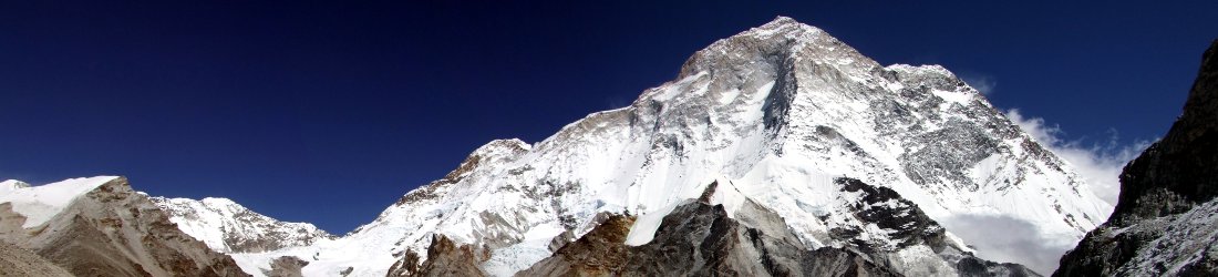
Glyder Fawr was a more straightforward summit, though equally rocky. Two small outcrops competed for the position of highest point, so we climbed both. Glyder Fawr has one of the best views of the Snowdon Horseshoe, facing onto the long rocky ridge of Crib Goch and Crib y Ddysgl, with the summits of Y Lliwedd and Snowdon poking up behind.
We descended the boulder-clad slopes of Glyder Fawr to the pleasant grassy col which divides it from the third 3,000er Y Garn (947m or 3,107ft). We had lunch beside the tarn of Llyn y Cwn, which we soon discovered has now become a popular spot for the new craze of wild swimming. We heard a few whoops behind us as we were leaving, and turned around to see a group of people popping their clothes off and jumping in.

The summit of Y Garn was busy. It is certainly the easiest and quickest peak to ascend in the Glyder range, a short hike up from the car park at Ogwen Cottage (assuming you don’t have to park on the verge somewhere on the road to Cardiff).
Beyond Y Garn it was much quieter as we found ourselves on a high path over grassy tops with all the peaks of North Wales visible around us. We extended our walk to Carnedd y Filiast, the northernmost point on the ridge, before doubling back to climb our fourth 3,000er Elidir Fawr (924m or 3,031ft).
The geography of these peaks is somewhat confusing, rising as they do above the start of the Lleyn Peninsula, which sticks out into the Irish Sea like an arm thumbing a lift from a taxi driver across the water in Dublin. In slightly bizarre fashion you can see the sea in three directions and land in four. Our posh hotel was somewhere below us, but I couldn’t work out where.
We descended from Elidir Fawr down a ridge that was marked on the map as the Mushroom Garden and was notable for not having any mushrooms on it. After passing a few more wild swimmers in Llyn Idwal, we walked back along the road to our car, reaching it at 6pm with 4 out of 14 peaks down.

Back at our hotel that evening, enjoying a rather fancy duck parfait, I pulled up the Met Office mountain forecast and was shocked to discover that the forecast for the following day on Snowdon was atrocious. In fact, it couldn’t have been worse, with thunderstorms first thing clearing to heavy rain by late morning and more thunderstorms at 2pm.
Edita looked out of the window and watched soft sunlight lowering gently beneath the horizon.
‘I don’t believe it,’ she said. ‘It must be wrong. I think the weatherman has been drinking too much at the Queen’s jubilee.’
We decided to stick to our plan of climbing the three Snowdon 3,000ers anyway. If we didn’t. then our challenge would be over.
Having done the Snowdon Horseshoe with Edita in 2015, an alternative route up Snowdon was called for this time around. I decided we should climb the west side of Snowdon, starting from the village of Rhyd Ddu, where a link path slants across boggy moorland to join up with the Snowdon Ranger Path to the summit. We could then traverse the summit and join the Rhyd Ddu Path back down again.
Those of you familiar with Snowdon may be sensing one glaring flaw with this plan if you want to tackle all three of Snowdon’s summits. That flaw is Crib Goch, the fearsome knife edge that contains one of the three summits. There are generally only two ways to tackle it: upwards, east to west (the normal way, given that it’s much easier to climb up than down), or downwards, west to east, a direction that requires many more moments of touching cloth.

Our chosen route was going to require a third way: downwards, all the way down Crib y Ddysgl, a bonus knife edge that would have a fearsome reputation of its own were it not overshadowed by Crib Goch, then back up and most of the way along Crib Goch to tag the summit. We would then need to turn around and go back again. Crib Goch’s knife edge twice, if you like.
In fact, there had been a nasty moment the previous day as we sat on the summit of Elidir Fawr with a can of Brewdog, surveying the Crib Goch ridge and trying to figure out the highest point. It looked awfully like the very end of the ridge, which would mean straddling the entire thing then turning round to do it all again. I doubted if my trousers could survive that. But the highest point also looked like it could be halfway along, and in fact this is where the summit is marked on the map. We would still need to do all of Crib y Ddysgl (twice), but only half of Crib Goch (twice) would be needed.
In the plus side, Edita was proved right about the weather. The Met Office weather team appeared to have been to one of Boris Johnson’s work meetings, emerging with their forecasting abilities grossly impaired. The forecast of the previous night had been hopelessly wrong. Happily, by the morning the forecast had been corrected. Clouds hung over Snowdon’s summit, but it was sunny down below.
The Snowdon Ranger Path isn’t Snowdon’s finest, and nor is the link path from Rhyd Ddu, which crosses a slate quarry and boggy moorland. We slogged uphill in tedious zigzags until we crossed the railway line close to the summit (no, you didn’t misread that – there is a railway line, the Snowdon Railway, and you can read all about its history in my book Seven Steps from Snowdon to Everest).

The tedium quickly vanished as we crossed the summit of the first 3,000er Garnedd Ugain (1,065m or 3,494ft) in thick cloud and started descending Crib y Ddysgl’s ridge. The mist decided to clear as we climbed down, which meant no option but to stare down the knife edge. There is a section on Crib y Ddysgl resembling the Giant’s Causeway, like a series of uneven cobbles but with terrifying drops on either side. This is easy to go up, but not so easy to shuffle down.
Every time I do Crib Goch I tell myself never again, yet here I was for a fourth time. There are two pinnacles to cross near the western end with exposure that would make a streaker blush. The first I remembered and passed to the left of, but the second I’d forgotten about. It took me a few attempts to find the narrow ledge around its right side.
These pinnacles are probably the hardest bit. I didn’t find the actual knife edge that some people straddle too bad. You can shuffle along it crab like with plenty of places to put your hands and feet. The ridge was mercifully quiet. Although we were going against the flow, there were plenty of places to pass all the hikers coming the other way.
By the time we reached the actual summit of Crib Goch (923m or 3,028ft), halfway along the knife edge, my confidence was up and I knew all the moves for the return journey. It was a hell of a lot easier scrambling back up the ridge than it was going down.

We raced back and crossed over the summit of Garnedd Ugain for a second time to join the crowds making their way up to the summit of Snowdon (1,085m or 3,560ft). As I strode up the steps of the summit platform, I could hear a man off to the side getting angry with me. To my surprise, I could now see an orderly queue of about 20 people on the other side of their platform, awaiting their turn on the summit.
I was too amazed to apologise to the man (and his tone hadn’t leant itself to an apology, so I ignored him). I know in these days of social media you’re supposed to have an opinion on just about everything, but I’m not exactly sure where I stand on orderly queues to summits. In the old days you would just crowd onto the platform with 30 other people and take your selfie. There were no problems; no fights. I couldn’t even imagine how a scrum of hillwalkers could form itself into an orderly queue. Did one of them work at an airport?
But one thing seems clear to me. Snowdon’s summit is easily big enough to accommodate a few hundred people, so if there’s no longer enough space on the tiny manmade platform they’ve erected on top then perhaps they should just get rid of the platform. That way everyone can have their photo taken on the highest point without difficulty.
It was still cloudy on the summit and, not having looked for it for a few years, I had difficulty locating the top of the Rhyd Ddu Path. Once on it, however, we soon emerged from beneath the cloud blanket and found ourselves staring down Bwlch Main, one of Snowdon’s most underrated features.
‘Another ridge!’ Edita said, her eyes lighting up with excitement.

Thankfully this one is no knife edge, a wide path navigating its narrow top. Somewhere to the east we could hear distant thunder, but it never reached us. A short distance along Bwlch Main, the Rhyd Ddu Path diverted down to the right, missing the summit of Clawdd Coch by a whisper. It took us down to another ridge, Llechog, and provided fine views across the valley to another, the Nantlle Ridge that we traversed a few weeks ago, before depositing us back at the car park in Rhyd Ddu at 4.30.
Back at our country hotel that evening, I read the Met Office mountain forecast with one eyebrow raised as I enjoyed a splendid filet de bœuf rôti en croûte de champignons (that’s beef wellington for you campers).
There was to be a cold east wind on Carnedd Llewellyn tomorrow, with gusts reaching 38mph. Temperatures of 5°C would feel closer to 0°C.
‘It’s June, for Christ’s sake. This must be wrong,’ I said as delicately flavoured mushrooms caressed my throat.
‘Just ignore it, Edita said.
It was sunny when we left the hotel the following morning, but the sky had clouded over by the time we parked up in the Ogwen Valley. The sun threatened to burst forth as we climbed up into Cwm Lloer. We kept stopping to put our jackets on and take them off again. At one point we even splashed on sun cream, though this proved as useful as a fish’s raincoat.

By the time we were halfway up the east ridge of Pen yr Ole Wen, we were well and truly in cloud and the wind was howling. Visibility was down to a few metres. We crossed the first three summits, Pen yr Ole Wen (978m or 3,209ft), Carnedd Dafydd (1,044m or 3,425ft) and Carnedd Llewellyn (1,064m or 3,491ft) into the teeth of the east wind.
The ridge leading up to the latter was particularly bad. At one point we had to cross to the west side and huddle behind the wall of an abandoned shepherd’s hut to put an extra layer on. I was now wearing three layers and Edita five. I was worrying about my fingers freezing in my thin liner gloves when a young lad ran past us in shorts. He floated up the hillside as though the gradient wasn’t there.
These wintry conditions persisted for the whole morning as we made our way across the featureless plateau to the fourth summit, Foel Grach (975m or 3,199ft). In the old days, navigation would have been difficult, but now I could just fish my phone out of my trouser pocket and follow the pointer on the Ordnance Survey app, right up to the pile of stones marking the summit.
We were cold and hungry, but this wasn’t a good place to stop. I was intrigued by the word ‘Shelter’ marked on the 960m contour line. Sure enough, there was a small stone building with a corrugated tin roof. I pushed the door open into a small dark chamber. It was surprisingly clean and dry, so we sat inside to eat our lunch.

It was the first glimmer of hope in a depressing day, and it marked a turning point. After lunch we opened the door to go outside and were surprised to find a view of sorts. We could see the outline of Carnedd Gwenllian and Foel Fras where previously there had been a wall of fog.
The former was no summit at all, just a pile of stones on a grassy ridge, but we went up it just to say that we’d done it. Foel Fras (944m or 3,097ft) was more of a hill, gently curving over boggy grassland and rising for far too long. It was the outlying point of our walk. From here we would turn around and retrace our steps. We raced up it. A dry stone wall crossed the summit, which was marked by an Ordnance Survey trig point.
‘This is my least favourite summit,’ Edita said.
It was true. We had come a long distance for not very much. There looked to be quite a nice skyline walk, following a grassy ridge over a series of summits marked by large cairns, with views out to the north coast. But these are featureless hills compared with the grand pinnacles, towering cliffs and rocky ridges further south.
We returned to Carnedd Llewellyn to climb the 13th and penultimate summit of our trip, the outlier of Yr Elen (962m or 3,156ft). It was quite a nice summit, standing on its own at the end of the western arm of Carnedd Llewellyn. We stopped for a second lunch before crossing Carnedd Llewellyn for a third time and continuing down its east side.

An unpleasant morning had finally, if grudgingly, transformed itself into a pleasant afternoon. We were now in a peaceful corner of Snowdonia where the scenery was just as picturesque. I’d been this way once before on a backpacking weekend and forgotten all about the scramble along the ridge to Pen yr Helgi Du which I had somehow managed with a big pack. Another interesting scramble up the other side led to a surprisingly boring summit like a grass field. A gentle grassy ridge called Y Braich led back down to the Ogwen Valley. My old man’s knees were hurting by then and I staggered down awkwardly.
As we followed the Snowdonia Slate Trail back to our car, we had a chance to study the north ridge of Tryfan, which was to be our 14th and final summit of the weekend. It looked daunting. It was supposed to be an easier scramble than Bristly Ridge, but it was twice as high. I climbed it on one previous occasion. I had been so fed up of scrambling by the time I reached the summit that I declined to continue up Glyder Fach via Bristly Ridge, instead opting for the easy scree slope alongside.
As things transpired, we didn’t climb the north ridge this time either. I didn’t even bother to check the weather forecast when we got back to the hotel. It didn’t matter. We had to climb Tryfan whether we liked it or not, come rain or shine, or a great holiday weekend would feel incomplete. What came was rain, lots of it. It pissed down all night, and it was still pissing down by the morning. I checked the forecast, which confirmed it would piss down for the rest of the day. This time it was right.
I didn’t fancy 700m of scrambling up the north ridge over wet slippery rock, so we decided to climb Tryfan (918m or 3,012ft) straight up and down the ‘easy’ route from Ogwen car park (which, surprise surprise, was empty this morning) up a paved footpath to Bwlch Tryfan and then up the south side.

There is no really easy route up Tryfan. Even the last 90m up the south side is over large, jagged boulders, easy to scramble up, but also easy to trip over and twist an ankle if you’re not careful. In wet rain it wasn’t much fun, but at least we had the mountain to ourselves.
The traditional true summit of Tryfan is marked by two large rectangular boulders separated by a metre of fresh air. They are known as Adam and Eve. You’re supposed to climb up onto one of them then jump onto the other, but not on your nelly will I ever do that. It’s a rock climber’s move to get up there and a rock climber’s fall over the east face if you don’t manage the leap with utmost precision.
We took our photos beneath the two rocks to show that we’d been there, otherwise the photo could have been taken anywhere in Scotland, then we raced back down (well, actually we eased our way carefully back to the col, then raced).
The whole walk took just over three hours, which meant we could have lunch in the very friendly Tyn y Coed Inn, Capel Curig, before driving back to the Cotswolds.
It was a fantastic weekend and hugely satisfying. 14 peaks ticked in just 4 days with some enjoyable scrambling to boot. Nirmal Purja? Who’s Nirmal Purja?

At the end of it all, I had no idea what went on at the Queen’s jubilee celebrations, but I wasn’t alone in that respect, because Her Majesty didn’t show up for them either.
Somebody asked me for GPX files of one of my previous hikes. I don’t go in for GPX files myself, but I do use the Ordnance Survey app for navigation and I noticed that you can download the GPX from there. So I have made the routes public on OS online and provided links below, along with some interesting facts and figures. Hopefully some of you will find this useful. You can also see the rest of my photos here.
Day one: 1. Glyder Fach (994m), 2. Glyder Fawr (1,001m), 3. Y Garn (947m), 4. Elidir Fawr (924m)
Total distance: 21.44km. Total ascent/descent: 1519m.
View route map and download GPX
Day two: 5. Garnedd Ugain (1,065m), 6. Crib Goch (923m), 7. Snowdon (1,085m)
Total distance: 17.75km. Total ascent/descent: 1398m.
View route map and download GPX
Day three: 8. Pen yr Ole Wen (978m), 9. Carnedd Dafydd (1,044m), 10. Carnedd Llewellyn (1,064m), 11. Foel Grach (975m), 12. Foel Fras (944m), 13. Yr Elen (962m)
Total distance: 26.6km. Total ascent/descent: 1645m.
View route map and download GPX
Day four: 14. Tryfan (918m)
Total distance: 5.44km. Total ascent/descent: 630m.
View route map and download GPX


This was great. Thanks so much for the tribute effort but also for excellent commentary and photos. (My last climb was Upper to Lower Slaughter in the Cotswolds)
Lovely villages, but that’s downhill, surely?
70 years on the throne, that’s one hell of a dose of squits
Yes indeed, Your Highness. Couldn’t you ask Camilla to go in and help her?
Clawdd Coch? Home of the honey badger?? You’re raising the tone as usual, Mark, with this reference to Claud Cockburn (1904-81), a famous master of wit and repartee.
Or was this a Sausage Joke from the start?