
You may have heard recently that the Ramblers Association, the UK organisation for leisurely walking enthusiasts, has launched a campaign to reclaim some of Britain’s lost footpaths before legislation comes into effect that turns them permanently into private land. Citizens now have until 2026 to rediscover lost footpaths before they are gone for ever.
The campaign is accompanied by the launch of a clever app which I had some fun with last weekend. But before I come to that, some of you may be scratching your heads wondering how such a situation exists. Surely in a developed country like the United Kingdom, land is either public or private — if the land is public then people can walk on it, and if it is private, they can’t?

But it’s not that simple. This is a country where there is still a law which says that all beached whales and sturgeons must be offered to the reigning monarch. If Charles Dickens were alive today, he could write an 800-page novel about laws, landowners and impoverished hikers on public footpaths that would make the court case Jarndyce v Jarndyce in Bleak House seem straightforward.
Britain is blessed with a network of public footpaths that are open to the public but pass through private land such as farmers’ fields, private driveways and even people’s gardens. Until 1949 these paths may have been recorded on maps, but this didn’t mean that they were enshrined in law. Knowledge of some were probably passed on by word of mouth, from father to son, storyteller to audience, or strummed about in alehouses by wandering minstrels.
Then in 1949, the National Parks and Access to the Countryside Act required local authorities to make a record of all such public rights of way. Unfortunately, finding them wasn’t easy. Nowadays you can identify them by a green dashed line on 1:25,000 Ordnance Survey maps which cover the whole country. It took local authorities until 1982 to complete the definitive maps with all public footpaths.
However, even these maps were not considered comprehensive; there have still been disputes about old paths not shown on maps which have nevertheless existed for centuries. To prevent such disputes going on for ever, some rules were introduced in the 2000 Countryside and Rights of Way Act (CroW).

This great piece of legislation introduced the ‘right to roam’ over 865,000 hectares of open moorland, heath and mountains that are privately owned. But it also introduced a 25-year deadline by which all public footpaths need to be identified. This deadline ends in 2026. The Ramblers Association have therefore launched a campaign with the droll title Don’t Lose Your Way aimed at getting members of the public who are keen hikers to help identify lost footpaths.
You may be wondering, I’m a keen hiker, but how the hell do I identify a lost footpath?
This is the clever bit about the campaign. The Ramblers have released a tool on their website which allows you to overlay current Ordnance Survey maps with old historic maps from 1888 and 1897. This allows you to easily spot any footpaths that exist on the old maps but aren’t shown on modern ones. These footpaths are all candidates for reclaiming. I decided to give it a go, and what fun it was.
Where we live in the Cotswolds there are quite a few public footpaths that end abruptly at roads. In order to join footpaths together it’s necessary to walk for a few miles along roads. Fortunately the roads around here are quiet, without much traffic, but many times I’ve wondered why all these footpaths end in odd locations. Were there once paths in between that have now been swallowed up by farmers’ fields?
Before I started making mischief in my local area, I decided to experiment with the tool by travelling to Bodmin Moor in Cornwall, where my Uncle Mike used to farm 500 acres of land owned by the Duchy of Cornwall estate.

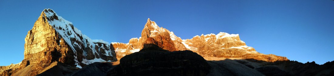
It’s a place with bittersweet memories. It’s a lovely spot to go walking (when it isn’t raining), with a line of hills — Caradon, Cheesewring, Sharp Tor and Kilmar Tor — rising prominently on the horizon, and Cornwall’s highest peak, Brown Willy, not far away. These hills are famous for their granite tors — slabs of stone piled on top of one another like saucers. You may wonder how they were erected, but in fact they are entirely natural and were formed by erosion over millennia.
Beneath the peaks, the hillsides are littered with something less natural: relics of Cornwall’s industrial history. Ruins of abandoned engine houses are all around; crumbling chimneys that once served the tin mines, rise from fields. You have to be careful if you find an overgrown hollow on the moors; some of them are abandoned mine shafts. At the time of writing, the Wikipedia page for CRoW even features a signpost from Bodmin Moor, warning hikers of the dangers of wandering too freely among the abandoned mines.
My Uncle Mike was a dairy farmer who spent the latter part of his farming life producing Yarg cheese, a cheese wrapped in nettle leaves that I often saw on restaurant menus in London. He had a farm shop and members of the public could go on tours of the dairy and farm led by tour guides in mock Friesian cowhide trousers. It was a successful business and he was eventually able to buy his 500 acres of land from the Duchy of Cornwall estate (which meant Prince Charles, Duke of Cornwall, was no longer his landlord).
As a bonus for farm tourists, he installed several footpaths so that people could wander freely around the farm. Although these paths were open to the public, they were designated as ‘permissive paths’. This means they were not public rights of way that are open to the public in perpetuity — Mike was allowed to revoke their permissive path status at any time and turn the footpaths back into private land.

Uncle Mike passed away a few years ago, which means he won’t get annoyed by me testing the Ramblers’ tool out on his farm. I was curious to know whether any of these permissive paths had in fact been footpaths in 1888.
The tool allows you to select a 1km x 1km square on an Ordnance Survey map and overlay the 1888 map on top of it by means of a slider. Any paths on the 1888 map marked with the legend F.P. are footpaths. If these are no longer marked with green dashes on the current Ordnance Survey map then they are candidates to be reclaimed by the Ramblers Association. You can mark them on the map with a pencil tool and submit them to the Ramblers for further scrutiny.

I selected the square where Uncle Mike’s permissive path ran from his old farm Netherton across a field, over a footbridge then alongside a stream to Sterts open-air theatre in the village of Upton Cross. Unsurprisingly, this isn’t marked as a public footpath on the current map, but would it be marked as a footpath on the 1888 one?

The answer was yes. I could hardly contain my excitement (well, actually I could, but that makes for a less interesting story). There on the 1888 map was the F.P. symbol.
I kept sliding. Alas, I could see that only half the permissive path, up to the footbridge, was once a footpath. I drew the path onto the map with the purple pencil line and clicked ‘Submit’.

But then my eyes were attracted to a couple of F.P. symbols on the two squares to the north of Mike’s path. As far as I could remember, these had always just been fields with not even a permissive path across them. The 1888 map was clearly showing a footpath all the way down a valley to the village of Darleyford.

I asked Mike’s brother about it, who happens to be my 78-year-old father Ian — who is very much still alive and is inhabiting (I was going to say ‘squatting in’, but that would be harsh) our cottage in the Cotswolds while he waits to exchange contracts on a new house. He escaped Netherton Farm when he was a teenager, and fled to the north of England to become a pig psychologist at Hull University. Did he ever recall there being a footpath across that patch of land?
‘Giddarn buyy, faaathr alwis said th’poostmun used to goo the wuyy,’ he replied.
I’m not very good at languages and I still really struggle with my Italian listening exercises. But I had grown up listening to my father’s mock-Cornish dialect, which makes him sound like he’s a member of The Wurzels. I was thus easily able to understand that in my grandfather’s day (who owned the farm before Uncle Mike), the postman used to walk along that path to deliver mail to the farm. The path isn’t on the current Ordnance Survey map, so I drew another purple line and submitted it to the Ramblers.
I was curious to know why it had disappeared. I knew this was Duchy of Cornwall land, so had Prince Charles, heir to the UK throne, stolen it? [*] Dad explained that he remembered other paths from his youth. They only existed because people tramped over them. If people stopped using the paths then nature just reclaimed them and they vanished without trace.
He did, however, admit that when my grandfather ran the farm, many of the hedges were deliberately removed to create more farmland. He said that he remembered doing some research for a book called Linkinhorne: The Story of a Cornish Parish, a collection of essays by local people. During his research he discovered that Netherton Farm had once comprised over 60 fields but now there were just nine.

I happened to have a copy of this book on my shelf. One of the ‘local people’ in question had given it to me, though I couldn’t imagine there would ever be a time that I would actually read it. But now that time had come. I dug it out and glanced at the table of contents.
Imagine my excitement when I saw there was a chapter called Linking Linkinhorne: Highways and Byways (‘excitement’ is probably the wrong word, but ‘indifference’ wouldn’t be fair either).
‘Oh, is there? Who wrote that one — was it Mike Todd?’ Dad replied, alluding to a member of Linkinhorne Parish Council who was well known for tramping local footpaths to keep them in use.
I flicked to the chapter in question, then roared with laughter.
‘It says Ian Horrell. Don’t you remember writing it?’
I decided to read it, and much to my surprise I found it quite interesting. Dad had studied not only the old Ordnance Survey maps from 1809, 1894, 1906, 1919 and 1963, but a map from 1699 by a chap called Thomas Martyn and a ‘Tithe Assignment’ map from 1842.
Anyway, to cut a long story short, I reached for the pencil tool in the Ramblers’ Don’t Lose Your Way app and drew the footpath back on. This ancient path had once existed across the Duke of Cornwall’s estate, but had disappeared through lack of use and because one of the Duke’s old tenants had ripped up the hedges. That tenant was my grandfather Douglas Horrell, so it’s only right and proper that I should rediscover it and put it back on the map with the help of the Ramblers.
Hopefully others will do the same, and go to the Ramblers’ website, use the app and reclaim more of Britain’s lost footpaths. But there’s even more that can be done. In his chapter of the Linkinhorne book, the prominent local historian Ian Horrell (my arse) remarked that:
Much the most detailed map of parish tracks is the 1842 Tithe Assignment
The Tithe Assignment maps are owned by the National Archives, so you can probably go and research the hard copy versions in some dusty old library somewhere. Unfortunately the only online versions appear to be held by The Genealogist, an organisation in Jersey that provides help with researching your family tree. They are therefore quite expensive.
Currently the Ramblers Association app allows you to overlay two old maps: the Ordnance Survey one from 1888-1913 and less useful Barthomolew maps from 1897-1907 that show old roads. I wonder if the Ramblers have plans to add earlier maps such as the 1842 Tithe Assignments. This would provide an extra source of information.
Anyway, if you’re a keen walker of Britain’s footpaths and like looking at old maps, then I recommend getting involved in this worthwhile project by joining the search for Britain’s lost footpaths. It’s actually quite good fun.
[*] In case Her Majesty’s lawyers are reading this, I would just like to say that HRH did not steal this footpath, and the title of this post is what is known in bloggery as ‘clickbait’.


Good fun indeed. Especially when you’re rediscovering your family history too!
We have an interesting situation here in New Zealand where the margins of waterways and coastlines are protected for public access by the “Queen’s chain”; but somehow, in some places, adjoining landowners own the land to the water’s edge by a device called “riparian rights”. How they acquired those rights is a mystery to me, but I, and many others, don’t recognise riparian rights, and risk being served with a trespass notice (valid for two years) if caught crossing private land.
Copies of the Tithe Map are held by Cornwall Record Office, now Kresen Kernow in Redruth. our Local History Group hold a copy on DVD which can be made available at our Archive meetings in Rilla Mill Village Hall on the first Monday of the month at 1930.
Mike Todd
Is that *the* Mike Todd? Thanks for posting and thanks muchly for the useful info. Dad says hi.
Good on ya, Brian. May you (and I) ramble at will.
Interesting stuff! The Duchy’s tentacles reach all the way to North Yorkshire, I can report. Good to hear about my old colleague the pig psychologist, too. He might remember me as the sleep doctor. Still cultivating my patch in Harwood Dale, which got 2000 trees courtesy of the Forestry Commission over ten years ago, some of which are now suffering from ‘ash die-back’. Say hi to Ian. All best,
Jake Empson
Your father taught me animal behaviour at Hull in the mid 1990s as I was completing my BSc(Hons) in special psychology… I will never forget Dr Horrell’s generosity and sense of humour. He made the culture shock from the inner city of Manchester to the university community of Nicholson Hall so much more easier for me. He was loved by many of the psychology students at Hull!
Thanks for the kind words about the old chap. I will let him know!