
Welcome to this, the second in my series of Apennine ‘up the backside’ posts, so called because I tackle the mountain from the opposite of its usual side. I have previously talked about an ascent of Monte Marsicano via its rear passage. In this week’s post I tackle Monte Amaro (2,793m), the second highest peak in the Apennines.
In Italian, Monte is not a gentleman’s name but the short form of the word ‘mountain’, used in much the same way as we use ‘Mount’ in English, by appending it to the front of the name to indicate that it’s a mountain rather than (say) a city, monument or other tourist attraction. For example, some people like to say Mount Everest, Mount Kilimanjaro, Mount Snowdon, Mount Arthur’s Seat, etc. (though the last one sounds more like an action that should be practised in private). Amaro, on the other hand, means ‘bitter’.

But I’m digressing. Monte Amaro is the highest point of the giant Maiella plateau, a moon-like tableland in the western side of Italy’s Abruzzo region. It’s a mountain we had already climbed from the north and west sides and we had explored the northern plateau at great length. But the southern side of the Maiella plateau was unknown to us, and I knew that a route from the south would take us over several more Apennine 2,000ers.
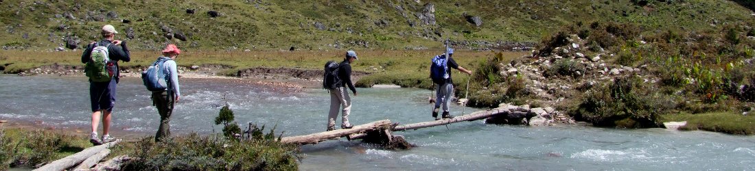
We took the road south of Sulmona, through the village of Pacentro. This road has seen several landslides over the years. Edita was driving, and we passed a couple of signs that claimed the road was impassable, but although she had to weave around the odd boulder, the road was still intact.
We parked up in a green valley beneath the 2,061m Morrone massif, with the massive wall of the Maiella plateau rising even higher on the other side of the valley. The parking spot was marked as 1,249m on our Edizione Lupo map, which meant we’d be climbing over 1,500m to the top of Monte Amaro and then some more over multiple summits. It was going to be a big day.

We took the P5 walking trail that aimed for a side valley up the plateau, above an apron of beech forest. It was late July and very hot when we set off just before 10am. The path led straight into the forest, gently at first, then becoming steeper as the green leaves on the lower slopes changed into brown higher up, leaving a shallow carpet on the ground as we climbed in zigzags.
After a little under an hour we emerged from the forest at Fonte dell’Orso, where a water spout emerged from the rocks and a natural spring splashed the ground. The water was cool and refreshing. We knew we were going to need a lot of it today, so we gulped at our bottles and refilled them.
We could see the path above us traversing up the side valley. Behind us Morrone rose up like an island, a patchwork of dark forest green and lighter grassland standing sentinel over the urban lowlands of Sulmona beyond.

As we continued up the traverse to the plateau, we passed several people coming down. It wasn’t yet midday and they must have made very early starts. Perhaps this is a habit in Italy when it’s very hot, but they probably hadn’t driven all the way from Rome that morning like we had.
We saw one group avoiding the trail and scrambling down rough slopes to our left. The slope, known as Fondo di Maiella (‘Back of Maiella’), was crowned by a line of buttressed cliffs guarding the top of the plateau.
The trail took us through one of the intermittent gaps in the cliff. We reached the plateau at a place called Forchetta di Maiella at 12.30. We were now at 2,390m and although the bulk of the climbing was behind us, we could still see mountains rising above.

In front of us, the trail dropped to another exit on the opposite side of the plateau. To the left, a rocky ridge formed an elevated rim to the plateau. Somewhere on this rim was Cima di Fondo di Maiella (2,593m), hopefully the last of the 2,000ers we would be climbing that day on our return from Monte Amaro.
Across the plateau was the whale-back of Monte Macellaro (2,646m). A broad valley, Valle de Femmina Morte, or ‘Dead Female Valley’ for those of a morbid turn, ran north between these two peaks and somewhere at the end of it was Monte Amaro. I didn’t know if these females were cows, hens or humans, but I hoped we wouldn’t be finding out.
We turned our attention to the right, a more rolling landscape of grassy moorland, albeit at a high altitude. Somewhere up there were two less prominent 2,000ers for us to climb. There were no obvious mountains in this direction, so it was going to be more a case of finding the two highest points and standing on them.

We stopped for a short snack of cold bistecca sandwich from last night’s restaurant, then headed along the southern rim to our right. We walked over a brow, across a trough then up again until it became clear that we were standing on the highest point on the southern part of the massif.
This was confirmed by a home-made cairn daubed with black paint (not that I’ve come across many cairns that were machine-made, but this one looked amateurish). The paint read Cima di Fondo di Femmina Morte (2,487m). Whoever first catalogued the Apennine 2,000ers hadn’t been very imaginative with their naming (if, indeed, they were the ones to name them) but thankfully the peaks are more pronounceable than your average Scottish Munro.
To the south a new view opened out. Most prominent was the pointed cone of Monte Porrara. At 2,137m it was much lower than we were, but the peak was distinct from the Maiella plateau and therefore much more of a mountain. It wasn’t something we’d be climbing today, but it looked an inviting proposition for another day.

Closer to us, and within striking distance was the long grassy ridge of Tavola Rotonda (2,403m). We still had a long day ahead of us though, so we had to leave that one for another time too.
We looked east across the crumpled rolls of moorland and tried to identify the other 2,000er here. There was nothing obvious, but we decided upon a long flat hill on the opposite edge. We dropped down past a muddy pond then climbed gradually up again to the summit. It wasn’t much of a summit if I’m honest, but another crude cairn, this time emblazoned with light blue paint, proclaimed Cima de Femmina Morta (2,423m). It was another crap name, but there seemed to be a lot of things named after dead women, so I was just relieved that we hadn’t come across any corpses.
We could now look north, right up the valley of the same name and spy the silver dome of Monte Amaro rising up at the end, between Cima di Fondo di Maiella and Monte Macellaro. Its summit was only 350m higher than we were, but it still looked very distant.

After crossing another pass on the opposite side of the plateau from the place we entered (a plateau, you will only be mildly surprised to learn was called Fondo di Femmina Morte), we began the tedious ascent of Monte Macellaro. Tedious it certainly was, but it was also somewhat alarming. Macellaro means ‘I slaughter’ in Italian. My boredom at the ascent was mixed with concern at the prospect of finding some crazy Jack-the-Ripper running around on the summit with a steak knife.
If I had to sum up a mountain with a single word then Monte Macellaro’s would be ‘long’. If I were to be given the luxury of two words, it would be ‘tediously long’. There really is no other way to describe it. At the risk of sounding repetitive, it’s a long, thin mountain that stretches 57 miles from south to north — or so it felt as we plodded up its endless rocky slopes. It was actually more of a long plateau than a ridge, which meant the views were somewhat distant too.
By mile 38 we had passed the first of its many false summits and continued to another distant horizon. The second false summit came after 43, where we passed a herd of wild horses standing around and looking bored. Bored perhaps, but I’m happy to say they were not the femmina morte of legend. A brief glance revealed that the fillies among them were looking very much alive.

When we finally reached the high point of the mountain, it wasn’t really a summit at all, just a cairn on a barren plateau. We couldn’t even be certain it was the highest point at all. We read the paint marks on the cairn, which confirmed it as Monte Macellaro (2,636m). But there was another cairn a short distance away that was on the actual 2,646m high point. What a farce.
It was now 2.30 and I was hungry, so we stopped for lunch in a dip between the two high points. A cold wind blew through it and the skies were grey, so we didn’t stop for long.
We continued over the true summit. Up ahead, the silver arch of Monte Amaro still looked a long way, but the orange-domed shelter on its summit was clearly visible, so it wasn’t as far as it looked.
We dropped down to a broad basin with a crossroad of paths. It was late in the afternoon, but there were now many people crossing the plateau, the first we had seen since we were down below.

Gradually the path rose again to Monte Amaro. Someone had been having some fun with signposts. One said Non gridare, ascolta il silenzio (‘Don’t shout, listen to the silence’). A few metres later another said Non disturbare i camosci (‘Don’t disturb the chamois’). We’d seen lots of camosci on the northern side of Monte Amaro last time we climbed it, and a herd of them were grazing below the summit to our left. But we were too far away to disturb them.
We reached the summit at 4pm. There were two park rangers and a man with horses on the summit, but they all left soon after we arrived, leaving us alone to have a second lunch and (to steal a phrase) listen to the silence.
It was our third time on Monte Amaro’s summit and I was happy to be there. There was nothing bitter about this place and the views were sweet. I hadn’t registered the view south down the Femmina Morte valley on either of my previous ascents, but now it was clear: a gentle grey valley cutting through the plateau. We had come over Monte Macellaro, its eastern boundary, and we would be returning along its western one, which rose to its summit of Cima di Fondo di Maiella.

A more familiar view was the one to the west. Twice we had crossed and explored the series of silver plateaus and ridges that reached their high point on the summit of Monte Acquaviva. There were dramatic grey clouds over it now that we hoped wouldn’t reach us.
Here on top of Monte Amaro it was warm and sunny, but it was 4.30 by the time we left. We had become the last people on the mountain and we still had a long way back to our car 1,500m below.
Edita was anxious about the time, but I was glad we had continued to Monte Amaro and would have felt disappointed had we cut short our plan in order to get down earlier. We descended carefully down steep scree on the southern side of the summit. There was no clear path but it was the direct way down and it meant we avoided disturbing the camosci below the main trail.

Once down on safer ground I legged it rapidly along the western ridge of the Femmina Morte valley. Edita hurried in my wake. There were lots of summits, up and down, in stark but welcome contrast to the Macellaro eel-back across the valley.
I skirted beneath the summits to save time, and it took us only 45 mins from Monte Amaro to reach the top of Cima di Fondo di Maiella (2,593m), our fifth and final 2,000er of the day. We raced over it towards Forchetta di Maiella, the place where we had joined the plateau earlier in the day. But instead of continuing to it, we opted for a shortcut straight down the slopes of Fondo di Maiella, like we had seen others descending earlier in the day.
It wasn’t a pleasant option. The slopes were alternately rocky then grassy, but when we reached the grassy sections we discovered that they were hiding more rocks. The occasional scree chute allowed us to make quicker progress, but on the whole it was an awkward, knee-jarring descent, and it probably wasn’t any quicker than taking the long way round.

It was a big relief to reach the footpath again, a short distance above Fonte dell’Orso for a rest and a drink. Here Edita telephoned our B&B in Caramanico Terme to say that we were still up a mountain but coming soon.
Now it was Edita’s turn to take the lead. She literally ran down the path through the forest, and my legs were like jelly trying to keep up with her.
We reached the car at 7pm after a long and satisfying day. Heaven knows how many metres of ascent we had managed as we crossed those many summits, but 2,793 minus 1,249 makes 1,544, so it was at least that and more besides — probably something closer to 2,000m.
A whopper then, and it felt sweet to be back in Maiella.


