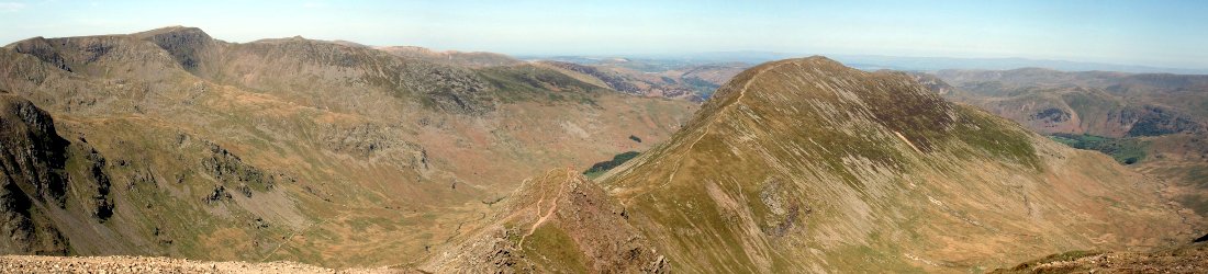

This is the first of two posts about Lhakpa Ri, a mountain in Tibet across the East Rongbuk Glacier from Everest. In this first post, I describe the first ascent by Bill Tilman and Edmund Wigram. In the next post, I will describe my own ascent 72 years later.
I’ve recently finished reading Mount Everest the Reconnaissance 1935 by Tony Astill about – it’s going to be hard to say this without teaching your grandmother how to suck eggs – the 1935 Mount Everest Reconnaissance expedition led by Eric Shipton.
The book is subtitled The Forgotten Adventure, possibly because not much has been written about it. The expedition is partly famous for what they didn’t do, which was to reconnoitre Mount Everest (or not). Unexpectedly, the British Mount Everest Committee had received permission from the Tibetan authorities for expeditions in both 1935 and 1936. They agreed that there wasn’t time to organise a full-scale assault in 1935, so Shipton was asked to organise a smaller expedition to check alternative routes on the north side and assess whether an attempt was possible during the summer monsoon season.

Shipton and his team reached as high as the North Col, where they concluded that monsoon snow conditions rendered a summer attempt too dangerous. The expedition is therefore better remembered for what followed. Having decided their reconnaissance objectives had been achieved, they spent the rest of the expedition exploring the surrounding countryside. In a few short weeks they completed 26 first ascents of mountains over 6,000m high on the north side of Everest, something Shipton described as ‘a veritable orgy of mountain climbing’.
While Shipton did write about the 1935 expedition in his book Upon That Mountain, he covered only their visit to the North Col and not the ‘orgy’ that followed. Tony Astill’s book can best be described as an edited collection of diary entries by the various team members rather than a full narrative account of the expedition. This makes for a sometimes uneven and laboured read; but as far as I’m aware, it’s the only book entirely about this expedition, which makes it historically significant and a valuable piece of Everest literature.
The book was interesting to me because my first 7,000m peak was 7,045m Lhakpa Ri, an easy snow slog lying just across the East Rongbuk Glacier from Advanced Base Camp on the Tibetan side of Everest. I climbed it in 2007 during a one-month expedition by the UK mountaineering operator Jagged Globe. Two days after climbing Lhakpa Ri, our team ascended to the North Col and I realised for the first time that climbing Everest was a realistic goal. Five years later I achieved it by the same route.
I knew that the legendary mountain explorer Bill Tilman made the first ascent of Lhakpa Ri with Edmund Wigram during Eric Shipton’s 1935 Everest reconnaissance expedition, but I had never read any account of the climb. Tony Astill’s book filled that gap for me.
Shipton and team had pitched their Camp III close to where climbers pitch Advanced Base Camp today, around the corner from the East Rongbuk Glacier, beneath the south face of Changtse. On 9 July they discovered the body of Maurice Wilson lying outside the wreck of his tent a short distance above their camp. Wilson was an English eccentric who conceived the idea of climbing Everest by crash landing a plane on its slopes and getting out to climb to the top. He took flying lessons and bought a Gypsy Moth aircraft. In 1934, he succeeded in flying single handed to India, but was denied permission to fly any further. Undeterred, he hired three Sherpas in Darjeeling, snuck into Tibet illegally and trekked all the way to Everest base camp. Until Shipton’s team made their discovery, his fate had been unknown.

Three days later, on 12 July, Shipton opened the route from Camp III to the North Col with two other team members, Charles Warren and Edwin Kempson. Tilman and Wigram had not been acclimatising well, so they were left in camp under strict orders to rest and recuperate.
Despite feeling weaker than the others, Tilman and Wigram didn’t much like the idea of sitting around in camp doing nothing. Looking east across the East Rongbuk Glacier, they were attracted by two modest peaks lying either side of the Lhakpa La, a high pass that George Mallory and his team had crossed on the first Everest expedition in 1921. One of these peaks had been named ‘Gardefui’ by Charles Warren.
Having been there myself, I can see quite clearly from the photo in Tony Astill’s book that the higher Gardefui is the very same Lhakpa Ri that I climbed in 2007. Lhakpa Ri (7,045m) rises directly above a snowy combe. To climb the mountain we had crossed this combe and climbed snow slopes on its left-hand side.
The left-hand margin of the combe is bounded by a rocky rib that passes a minor summit before continuing north-west to reach the second ‘Gardefui’ peak, a 6,896m rock and snow peak that can be seen on the left in the photo. In his 1921 sketch map, expedition cartographer Oliver Wheeler marked the Lhakpa La as being along this rib beneath the second Gardefui peak. However, behind this rib is a snowy col that can more properly be described as a pass. Opinion is therefore divided on which of these features is the Lhakpa La. This is the probable reason why the peak on the south side of the col has since been named Lhakpa Ri.
At 11am on 12 July, Tilman and Wigram decided to take a look at these peaks. Taking a light load of tent and food they set off. Although crampons had been invented a few years earlier, they were still not widely used in 1935. Without them, walking up easy snow slopes could be an exhausting labour, as climbers needed to carve a staircase of steps with their ice axe. It is perhaps for this reason that Tilman and Wigram chose to climb the rock rib rather than the snowy combe. After 2½ hours of steep scree, they were still some way beneath the minor summit. They decided that was enough climbing for the day, dumped their loads and set off back at 1.30. The sun was bright and they found it ‘a hell of a sweat’. It took them as long to descend as ascend, and they were ‘dead beat’ when they flopped back into their tent at Camp III at 4pm.

The following day, 13 July, they had a breakfast of porridge and set off again at 8am, this time carrying climbing equipment and bedding. They reached their previous day’s equipment dump at 10am, picked it up and resumed, now carrying larger packs of around 14kg. The ridge continued up a tongue of very loose scree. With their increased loads, they needed many halts, but they eventually reached the top of the scree at 6,700m and found a rocky platform where they could pitch their tent. By 1pm they were settled in for some rest. Tilman recorded in his diary that it was still blazing hot at 5.30pm.
They left their camp at 7am the following morning, 14 July, bound for the top of the first Gardefui (Lhakpa Ri). It took them an hour to reach the Lhakpa La, from where they took a ridge of crusty snow which steepened to a ridge of snow and rotten rock. This contrasted with my own ascent 72 years later. Our group didn’t climb as high as the pass; instead, we slogged our way up a tedious snow slope beneath it which, like Tilman’s route, became a steeper, more rocky ridge a few metres beneath the summit.
Tilman and Wigram reached the lower north summit and realised they would need to rope up to follow a short, narrow ridge to the main summit. (In 2007, my larger, less experienced group did not take this ridge, contenting ourselves with the north summit, which is about 40m lower.)
They reached the main summit at 10am. Here they would have had a fine view straight up Everest’s rarely climbed north-east ridge to the fearsome Pinnacles that would claim the lives of Pete Boardman and Joe Tasker nearly 50 years later. But it had clouded over and there was no view. Tilman had not enjoyed the ascent and recorded in his diary, ‘damn all high climbing’, which could be interpreted in a number of ways.
After eating biscuits and cheese, they returned to their tent by means of a ‘sitting glissade’ (something most small children would call tobogganing). This enabled them to reach their tent at 11am, only an hour after reaching the summit.

The snow conditions had tired them out and they didn’t feel like tackling the other Gardefui peak as they had intended. (This peak was also known to them as No. 3, but I have marked it on the map above as Gardefui II.)
They had virtually nothing to eat and nothing to drink. They also reported in their diaries that they had nothing to read or smoke, an abstinence that now seems quaint and old-fashioned. They eased their thirst by catching water from the rocks. Despite these difficulties, they decided to stay in their tent another night to tackle the second peak.
It was a wet, windy and cold night, and it snowed a lot. Luckily the second peak was much closer. Setting out at 7am on 15 July, they followed crusty snow along the ridge and reached the top at 8.30. It was cold, and again there was no view. The first ascent was bagged, but they were not tempted to linger. They descended immediately and were back at their tent within half an hour. After eating what remained of their food, they packed up and left by 10.30.
They appeared to take a different route back down, across a glacier – presumably the same snowy combe that my group ascended. They descended in a gathering storm, but were back at camp at 2pm.
While their fitter, stronger companions had been doing the hard work of escorting Sherpas with supplies up to the North Col in pursuit of their summer reconnaissance, these two layabouts had etched their names on a mountain that would eventually become a popular stepping stone for future generations of Everest climbers. It’s interesting to note that it took Tilman and Wigram four days and two overnight camps to accomplish an ascent that can be completed fairly easily in a single long day from Advanced Base Camp.
It snowed hard that night. Avalanches thundered down from the North Col. Shipton and his team would soon decide to abandon their reconnaissance and retreat from the North Col in dangerous conditions. On the plus side, once they were safely down they were able to join Tilman and Wigram on their mountaineering holiday.
In the next post you can read about my own ascent of Lhakpa Ri 72 years after Tilman.


You may be interested in the book ‘Invicible Spirit’ about Dan Bryant by the NZ author Lyn McKinnon. Dan was a member of the 1935 Everest Reconnaissance Expedition.
Thanks for the recommendation. Yes, indeed. Dan Bryant’s diary makes up a significant chunk of Tony Astill’s book.
Greetings Mark….
Great post and very interesting article.
As you will know the Lhakpa la was first ascended by our hero George Mallory and Guy Bullock on 21st August 1921…
This is the summit that once ascended, George famously said when he first set his sight on the awesome Kangshung face….
” Other men, less wise, might attempt this way if they would but, emphatically not for us.”
I have been to the south side of Everest on many occasions but never seen it from the North.
I plan to cycle from Lhasa to Kathmandu next year finally to view the North face.
Just wish i could have the view from Lhakpa la as you have experienced and described.
Unfortunately the price is against an ex postman like me…
Adventure peaks in Ambleside are asking 19k for the trip…
Keep up the great posts….
Regards as always…..