
Another Christmas, and another cottage in Scotland for a week. What would the weather hold in store for us this year, and would we get up any mountains?
Edita found us a cosy little place to stay in a row of cottages beside the main road outside Glencoe village. The forecast wasn’t promising. As Santa’s wife said when she looked out of the window, ‘it looks like rain, dear’ (you can keep reading — the jokes get better further on). On Friday 22nd, our first day, there were sudden showers and thick clouds over the mountains. We started lightly with a gentle stroll along the Caledonian Canal.
On Saturday 23rd, it rained heavily all day. We endured a 4-hour walk on firmer trails from our cottage in Glencoe village. For the most part, we followed the pavement along the main road as far as Ballachulish Bridge. We took a couple of diversions to avoid the roar of traffic.

The first, up into the Brecklet, an area of woodland above Ballachulish, was a pleasant enough walk along sheltered forest trails. The second, through forestry land above a bleak stone church disguised as a haunted house, was less successful. A track behind the churchyard was marked on the map, but it became lost in a tangle of jungle that warranted a machete. We didn’t have one, and after ducking beneath branches for a few hundred metres, we found our way blocked by a small stream that had been transformed into a raging torrent. We had no option but to retrace our steps and walk further along the road until we found a forestry track on the left. This track climbed high above the main road, but it was wide and provided no shelter from the driving rain that fired icy water pistols into our faces like an annoying child.
There was some respite when we descended into South Ballachulish and followed a sheltered cycle track back to the main road. Better still, we discovered that the bar was open at the grand old Ballachulish Hotel underneath Ballachulish Bridge. We enjoyed a pint and sandwiches as we dried out by the fire.
We walked back along the pavement as traffic roared past at 60mph. Waterfalls of rainwater gushed from the cliffs to our right. We had regular pauses when our passage coincided with that of a speeding car as it hurtled through a puddle.
The following day, Christmas Eve, was marginally better at sea level. The rain was comparatively light and not so relentless. But cold 60mph winds were forecast on the summits, with gusts as strong as 75mph. Obviously it wasn’t a day for heading up hills, unless you were looking to catch a lift to Nova Scotia. We found a nice walk in forest on the other side of Loch Leven, around the impressive Inchree Falls. Eight dramatic tiers of river fell 45m in thick curtains, though I couldn’t help thinking that it was only a fraction of the water we’d had splashed into our faces the previous day. The water cascaded through a narrow gorge. The forest was thin around the falls and there were a couple of good viewing platforms for the upper section.

The Christmas Day forecast was for solid rain from 10am onwards, but summit winds were expected to drop to a tolerable 20mph. This suggested that there might be a 2-hour window to walk in daylight without getting wet. There weren’t many mountains we could climb in two hours and be heading back down by the time the rainstorm started, but there just happened to be one a few minutes from our cottage.
Halfway along the road from Glencoe village to Kinlochleven, the freestanding peak of Garbh Bheinn rises directly north of the Aonach Eagach ridge. Reaching 867m, it qualifies as a Corbett (one of the 222 Scottish peaks between 2,500 and 3,000 feet in height, with a drop of at least 500 feet between them). The walk started more or less from sea level on the shores of Loch Leven, so it would be a reasonable ascent.
The day nearly started disastrously. In the early morning darkness, I narrowly avoided reversing into a ditch while parking up in a small roadside layby. It was only when we got out of the car to put our boots on that I realised we were only about a foot away from the edge.
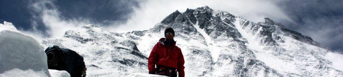
It was still dark as we started up the hill at 8am, but the sun was in the process of rising. We timed the weather window perfectly. The sky was clear for two hours and the walking was easy. A rough path led straight up Garbh Bheinn’s west ridge from the road, though it rose in three distinct waves. After a boggy start, the trail climbed steeply to the left to join the ridge on a shoulder marked on the OS map as Torran nan Crann. After a short respite across a boggy saddle, the trail climbed steeply again to reach the false summit of Stob Coire Sgoilte. There was a sombre feel to this section. Across the valley to our right, we could see the serrated edge of Aonach Eagach, where poor Dave Fowler, our guide on the Cuillin of Skye fell to his death earlier this year.

The clouds were approaching; as we arrived atop the stob, a light snow began to fall. Thinking we had arrived at the summit, I was dismayed to see a higher peak rising further on, but this turned out to be the highlight of the ascent. This final section was slightly more interesting with a short scramble up a rough shelf. We reached a frosty summit plateau at 10am at the same time as the clouds, which were now touching all the tops on either side. We descended in a snow shower by the same route, arriving back at the car at 11.30am, having got our white Christmas and the narrowest of summit windows. It rained heavily for the rest of the day.
A lot was resting on Boxing Day. Ever since arriving in Glencoe, all forecasts had pointed to 26 December as being the only good day of the week. Winds would drop below 20mph and visibility would be good all day. It was to be the only day of the seven that we spent in Glencoe when Munros might be feasible. Options were limited, unless we were willing to walk in the dark (which we weren’t). There are only 8 hours of daylight in northern Scotland this time of year. Our guidebooks quoted 7-9 hours for most of the Glen Coe Munros,* but times vary depending on the conditions. In winter, it’s a good idea to allow some contingency, as snow can slow you down quite a lot. Temperatures were mild for this time of year, 7-8°C down in the valley with buckets of rain, but as we discovered on Garbh Bheinn, this fell as snow on the higher summits.
Two of the easier Munros in Glen Coe lie at either end of the mountain known as Buachaille Etive Beag (‘small shepherd of Etive’, with small referring to the mountain rather than the shepherd). We circled this mountain last year by means of two narrow valleys, the Lairig Eilde and the Lairig Gartain, on a morning that was wet enough for ducks to need snorkels. The mountain stands alone, wedged between its big brother Buachaille Etive Mor and Glen Coe’s tallest peak Bidean nam Bian. It’s essentially a 2km ridge oriented SW to NE, with the 958m Munro of Stob Dubh at its southern end and the 925m Munro of Stob Coire Raineach to the north. The two Munros are divided by the 748m col of Mam Buidhe and the 902m central summit.
The ascent was billed as a 5-6 hour walk in our guidebook. It involved climbing up to the col from the north side and diverting each way along the ridge to bag the three summits. To be on the safe side we decided to make another dawn start at 8am.

Given that our hopes for the whole week rested on 26 December as our one good day, you can imagine our disappointment as we drove up the A82 in the dark, with rain hammering on our windscreen. Every drop fell like a pin, piercing our dreams. It was like sitting by the fireplace on Christmas Day waiting for Santa’s feet to appear at the chimney, only to see Matt Hancock emerge dressed in a turtle-necked Father Christmas outfit.
We drove slowly up the road as it weaved its way through the Pass of Glen Coe, and parked up in the car park at an altitude of 250m. We agreed to wait in the car until the rain stopped, but happily this happened while I was putting my boots on. We were away by 8.15 as the first rays of daylight started filtering through the clouds.
The weather was forecast to improve as we climbed, and be bright and sunny by 10am. I remained optimistic as we started up the Lairig Eilde with a few drops of sleet falling around us. Both the central and southern summits of Buachaille Etive Beag were visible above. There was a dusting of snow on the ground, but it was little more than a light sugar coating on the lid of a mince pie. We carried axes and crampons, but I didn’t expect to use them.
We knew from last year that there was a firm, well-maintained trail, but we weren’t expecting to find a granite staircase. We had the mountain to ourselves for the first hour, and we raced up the stairs as they slanted diagonally up Buachaille Etive Beag’s northern flank. The steps became icy as we approached the ridge and care was needed, but we were able to avoid the slipperiest sections by diverting off the path onto tufted grass protruding through a thin carpet of snow.

We reached the col at 9.30 and observed a faint lavender glow over Buachaille Etive Mor (‘big shepherd of Etive’) as we looked across the valley of Lairig Gartain. Buachaille Etive Beag’s neighbour is essentially a larger version of the same: a freestanding 3½km ridge aligned SW to NE, this time with five summits and a Munro at either end. It is more famous due to its prominence, standing sentinel over Glen Coe as you approach along the road from the east; and also because those cliffs guarding the eastern end have a rich climbing history.
We were directly beneath the northern summit of Stob Coire Raineach, but we opted to head south to Stob Dubh, the further Munro, first. We still had the mountain to ourselves, and I wanted to enjoy the solitude; we had started early, and I expected Glen Coe’s easiest pair of Munros to be busy on the only good day of the week.
There was a gentle ascent up to the central summit. About 50m above the col, the trail became less slippery as a thin carpet of snow buried the ice. Fifteen minutes later we crested the central summit and were faced with an incredible ridge walk. A broad snowy ridge curved gradually to the right, dropping slightly before rising in a gentle dragon’s back to the top of Stob Dubh. The summit looked distant, but this was deceptive. In reality, it wasn’t so far away. The wind was light; cumulus clouds boiled overhead, but there was plenty of blue sky above them. Occasional shafts of sunlight broke through, bathing the ridge in a yellow glow.
We reached the summit of Stob Dubh a few minutes after 10am. A large pile of stones marked the top, but it was one of those summits that have another pile of stones about 100m further along, so we had to go over to that one just to be sure that we’d reached the top. From there it was obvious that the first summit was higher. Although it was clear on top with plenty of blue sky overhead, angry clouds hung over all the adjacent summits, most notably the entire ridge of Buachaille Etive Mor, hiding the mountainous skyline we could otherwise have enjoyed. Thankfully, it was warm enough to keep the rain inside the clouds.

We returned the way we had come, and were nearly back to the central summit before we saw our first fellow hiker, a lone bearded man with large boots and bright red gaiters. There were a few more people climbing in pairs as we descended to the Mam Buidhe, but I counted no more than 10 of us on Buachaille Etive Beag in total that day. By the time we reached the col, the ice was beginning to melt and the path was less treacherous.
The ascent to Stob Coire Raineach was rougher and steeper than the one to Stob Dubh, but also much shorter. By 11.15 we were atop our second Munro of the day and my 152nd in total. It was warm enough to sit against a boulder on the northern side and eat sandwiches as we looked across Glen Coe to the navy blue stripe of Blackwater Reservoir on the edge of Rannoch Moor. Brown hillsides clad in aprons of snow circled the lake, but grey clouds hung over the summits and the normally dominant presence of Ben Nevis was nowhere to be seen.
We raced back down the mountain, marvelling at the workmanship of the granite staircase. We expected the steps to be icy and treacherous, but all of them sloped backwards slightly, rendering them safe to descend. We were back in the valley of Lairig Eilde before we knew it. The whole winter walk had taken only 4½ hours.
Later that afternoon back in Glencoe village, the sky was much clearer. We took the opportunity to walk out onto the mudflats of Loch Leven to take photos of the Pap of Glencoe and its adjacent Munro Sgorr nam Fiannaidh, both of which we climbed on our only good day last year (which had been much worse than this one). Some of you may be smirking at the name of the iconic little mountain that rises above Glencoe village. There’s no doubting how it got the name: the mountain is breastlike from most angles; but fans of pareidolia will be pleased to know that from the mudflats it also looks like a sleeping Jabba the Hutt.

A couple of hours after this fleeting glimpse, the skies darkened and that was the last we saw of the mountains of Glen Coe. The following day was wet and wild. It rained so heavily that the presents we bought from the craft shop three doors down from our cottage were soaking wet by the time we got back. We confined our walking to a stroll down to the Laroch Bar in Ballachulish for lunch. The tarmacked pavement was so waterlogged that we arrived with wet feet. The news was full of stories of traffic accidents and road closures. They were calling it Storm Gerrit, though Gerroff would have been better. Luckily, the worst to happen to us was when a car drove through a puddle on the walk back and slarted me with rainwater.
You have to temper your expectations when visiting Scotland in winter, but one good day on the hills makes it all worthwhile.
You can see all my shit photos from the week in my Glencoe Flickr album.
(*) In case you’re wondering, Glencoe is the name of the village, while Glen Coe is the valley.


