
Most of us have used Google Street View at some point to identify buildings, reminisce about a place we’ve visited, or just to have a good nosy around the neighbourhood and see what our neighbours look like stretched at funny proportions with blobs obscuring their features.
Don’t worry, this isn’t a post about Google Street View, but it’s kinder, mellower, more refined, engaging and adventurous younger brother.
In its early days, Street View couldn’t show any panoramas that you couldn’t visit in a vehicle — and it still doesn’t for most places. A few years ago they started to remedy this by sending people out with ridiculous-looking Street View backpacks that seemed guaranteed to make dogs, cattle and assorted wild animals chase after them, and rightly so. They released Street View Treks, including one of the Khumbu region of Nepal. They also crowdsourced off-road panoramas by allowing people to post their own Photo Spheres such as this one of Everest Base Camp.

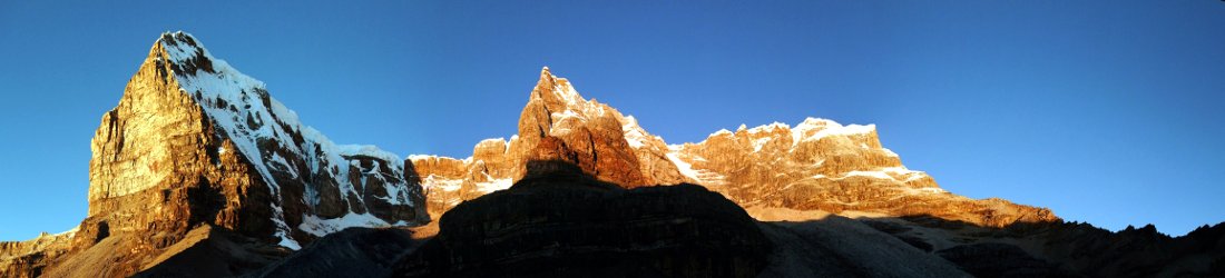
This much we already know about and have spent many an hour exploring. One site I hadn’t explored enough until last weekend, however, was Mountain Panoramas, a site featuring high resolution panoramas from mountaintops around the world, run by a German mountain enthusiast called Thomas Worbs.
I kind of vaguely knew about it, but hadn’t taken the time to explore it. The spur last weekend was a friend of mine, the Everest mountain guide Tim Mosedale posting to Facebook a 180° panorama he took from the summit of Everest last year.
Mountain Panoramas is superior to Street View in a number of ways, not only because it specialises in mountain vistas rather than street corners. The (mostly) 360º panoramas appear to be much higher quality, without the stretching effect you see on Street View, so it’s more akin to actually being there.
The feature I really love are the markers denoting features on the horizon. How often I’ve spent standing on a mountaintop with a map, trying to work out which mountain in the panorama is which. Mountains, of course, can look very different depending on where you’re standing. When you’re really familiar with an area and have climbed many of its peaks, you know instinctively which is which, but this is rarely the case in the Himalayas. Mountain Panoramas names all the surrounding peaks for you.
Even better, Mountain Panoramas allows you to fly like an eagle from summit to summit. Peaks that are identified in green have a corresponding panorama. Click on the green triangle and you are instantly transported to a point on the horizon to see the view from there.
From Tim’s Everest summit photo, I leaped down to the South Col to explore that enormous, desolate plateau. I was surprised to discover that there is a “South Col viewpoint”. I wonder how many Everest climbers have stumbled up it for an acclimatisation hike — probably so few that even Sir Ranulph Fiennes can count them on his fingers. But I whizzed up there to see Kangchenjunga, and an interesting view up Everest’s south-east ridge. I leaped back up to the summit, then flew to the top of Ama Dablam, before descending for thicker air at Tengboche monastery.

I had such fun exploring like a bird. I will have to go back there sometime.
Anyway, I was intrigued how all this was done. I’ve noticed Tim posting these panoramas one-by-one over many years and was surprised to learn that he hadn’t already done Everest. How many times did he have to climb the mountain before he could do an effective job?
I had a number of similar questions, so I fired an email off to him and he was kind enough to respond. It’s worth sharing the full interview, as it’s all quite interesting.
MH: When did you first decide to start working on these panoramas and what gave you the idea?
TM: It was Thomas Worbs (the creator and brains behind Mountain Panoramas) who got in touch with me asking if I would take some photos on Everest. He had found my website and liked the photos I already had there and the summit videos too. He felt that I was lucid enough on the video voice overs to remember all the things I needed to do to get the footage for a 360º panorama.
Then he taught me the dark art of getting the necessary footage. It needed quite a few sessions to perfect — he visited the English Lake District where I live, and I visited him in Bavaria a few times — and the rest, as they say, is history.
MH: It looks like you’ve done a few other panoramas for the site?
TM: Indeed. Over the years I have snapped away and brought lots of footage back including in Tashi’s prayer room (which sadly burned down in 2017) and Ang Phurba’s kitchen in Marylung
The Ama Dablam summit panorama was a real highlight but we’ve also got footage covering Thame monastery, the Renjo La, Gokyo Ri, Tengboche, Kala Pattar, Ama Dablam Base Camp, Island Peak summit, Everest Base Camp, the Lhotse Face and the South Col.
I have other footage too from South America (including a cracker from Cotopaxi summit), Bavaria and here in the Lake District which are all listed on my profile entry on the MPano site.
MH: How many attempts on Everest has it needed for you to get this panorama, and how many years have you been trying?
TM: Well I naively thought that I’d get it first time around back in 2013. On my first summit that season it was really cloudy and very Scottish and on my second summit a week later it was dark as we had made super quick progress. I’d taken two cameras, lots of spare batteries, a tripod and a special panoramic head to the summit both times!
2014 and 2015 didn’t happen because of the serac fall (2014) and the earthquake (2015). In 2016 it was a bit too busy, 2017 was too cloudy and although I was on the mountain in 2018 and 2019 I didn’t summit. 2020 didn’t happen (Covid) and so it was great to finally get some footage in 2021. On summit night I purposefully set off last to have a crowd-free summit (which it was) but unfortunately the plume had come in across the Kangshung face so a 360º panorama wasn’t possible but we still got over 180º.
MH: How many photos make up the panorama and how long did you need to spend on the summit to get them?
TM: It depends what lens I use. With the 12mm lens it takes around 60 overlapping bracketed exposures to get full coverage but with the 35mm lens it takes over 350. The 12mm is obviously a quicker process but there’s nowhere near the same clarity and you can’t zoom in as much.
A good pair to compare would be the 12mm footage at Ama Dablam Camp 2, where small rocks are clearly visible, and the 35mm footage at Ama Dablam Camp 3 where you can zoom in much more, it’s much sharper and you can even see climbers making their way to the summit.
MH: So you just take the photos then. Thomas does all the hard work of stitching them together?
TM: When you say ‘just’ there’s more to it than that! The kit is an extra 4.5kg which I always carry myself as the Sherpas are plenty busy enough already. It doesn’t sound like much but at ultra high altitude weight is the enemy and it all stacks up.
I get the equipment to the top, get everything set up and calibrated and then all being well I will have footage which I can send to Thomas. It’s not an automated process and it certainly isn’t the same as using an automatic stitch function on the camera which can give nice results but nothing like what we are producing.
There have been plenty of mishaps and I had a real cracker of a view above Camp 1 on Everest a few years back. There was alpenglow, orange sunset still on the highest peaks, a full moon and no one in the Western Cwm but sadly when Thomas zoomed in it was ever so slightly out of focus and wasn’t up to his very high standards.
When I am using the tripod and panoramic head he is looking for a tolerance of 6 or 7 pixels overlap using a 35MP camera. He often tells me that he can work his magic… but obviously not when it isn’t focused sharply enough. On the summit of Ama Dablam I got through 4 batteries really quickly because it was so cold. I was worried that the 5th battery would die before I’d completed everything so I rushed it and managed to miss a tiny overlap. Using other footage I had Thomas was able to copy and paste and even paint a few rocks and some snow and you would never know.
MH: We do now. Who adds all the labels of other mountains to the panorama and how do you manage to identify them all?
TM: That is Thomas who does that. He has a brain the size of a small planet and has created an algorithm so that when you publish a photo as long as you know where it was from, the elevation and direction it will work out what the skyline is. It needs a bit of manual input sometimes but it’s really clever stuff because it then recognises if there is an existing panorama from any of the listed peaks and shows them as green which are then clickable.
MH: Any plans to do some more? I know you climbed Lhotse last year too. Is a panorama of that in the pipeline?
TM: Alas the Lhotse summit last year was well and truly clagged in and, again, very Scottish so not a chance even though I had all the equipment with me. I’m hoping to get a Lhotse panorama this coming season as that will be an EPIC view across to Everest.
MH: Yeah, I’ve actually got a cloudy panorama from the summit of K2, but you’ll probably tell me that was taken in Scotland too. I see there’s a little cloud on the left hand edge of the Everest panorama. Any plans to go back and do it again?
TM: Well let’s just say that it would be really nice to have clear uninterrupted views from not only the summit but also the South Summit and the Balcony so watch this space!
MH: Actually, I was joking with that last question, but good on you, and good luck!
And if you’re interested in seeing Tim’s famous video from the summit of Everest, I managed to uncover it from YouTube for you. Here it is. If you’ve ever watched any of my summit videos you’ll understand why Thomas decided to ask Tim.


Oh, very cool! I’d never seen that site, and the Everest panorama is amazing.
Hi Mark, great blog post – thanks. Two things you might be interested in: (1) The mountain labels on MP (especially for Alps and UK) are generated in co-operation with udeuschle.de – a site we had discussed earlier here. (2) Some 360° panoramas from Abruzzo are upcoming on MP in the next weeks and months – from a trip which was inspired by your blog here. Cheers, Martin
Hi Martin, thanks. That makes sense. I remember your comment about udeutschle on the post I wrote about the view of Everest from Kathmandu and have used the site a few times since.
I was super excited about your second comment though. A little piece of me remains in the Apennines of Abruzzo. It’s one of my favourite places. There still isn’t much about them written in English so it’s really nice and flattering to hear that some of my posts have inspired others to visit. I really look forward to seeing the panoramas from those summits that I’ve stood on and hope to go back to. Thanks so much for letting me know.
Hi Mark, motivated by your comment above, we have fast-tracked the publication of a first view from Maiella on Mountainpanoramas: https://www.mountainpanoramas.com/___p/___p.html?panoid=2021_K5&labels=on — however, I must admit that I didn’t take quite the professional effort that Tim has described in the interview above. This is based on 44 free-hand images taken within 2 minutes.
A view from Corno Grande by Dirk on a very nice day to follow soon. Mountainpanoramas has Twitter and Facebook feeds for updates. Hope you enjoy it..
Many thanks, Martin. I have great memories of climbing Monte Amaro from Lama Bianca and continuing on to the three northern 2000ers, including Pescofalcone and Monte Rotondo. Thanks for bringing them back!