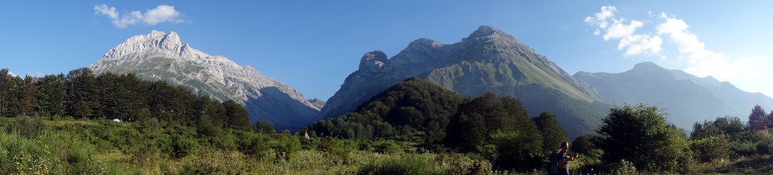

This is the first of two posts about Edita and my second ascent of Pico Duarte, the highest mountain in the Dominican Republic, via the Mata Grande Route. This post covers the early part of the trek from Mata Grande to Valle de Bao.
With Edita working in Haiti for a second year, we decided to return to the Dominican Republic to explore its mountains for a second time. This decision was made easier by our discovery of a reliable outfitter, Joel Roman of the local Dominican guiding agency Guias de Alturas.
The Dominican Republic has several mountain ranges that are criss-crossed with hiking trails, but we decided that we haven’t yet finished with its main one, the Cordillera Central. Last year we scratched the surface by climbing its highest mountain, Pico Duarte, by its quickest and easiest trail, the La Cienaga Route, which is, nevertheless, a decent, strenuous three-day hike.

This time we fancied a longer trek. My guidebook, the Rough Guide to the Dominican Republic, describes no fewer than five routes up Pico Duarte, most of which take 5-6 days. For your reference, here they are:
- La Cienaga (standard route); east side, 3 days
- Mata Grande; north side, 5 days
- Sabaneta; west side, 6 days
- Las Lagunas; south side, 6 days
- Los Corralitos; south-east side, 6 days
One wonders, however, whether the guidebook writers have trekked them all, or merely got the details from someone. My first thought was a grand north-south traverse of the Mata Grande and Las Lagunas routes. This was nipped in the bud quite quickly by master of logistics Joel, who was less familiar with the Las Lagunas route and thought that the roads on that side might be in bad condition. He said that a traverse of the Mata Grande and La Cienaga routes, however, would be quite straightforward, as Roselio (our guide from last year, who lives in La Cienaga) could take a horse to Mata Grande and return home via Pico Duarte, thus avoiding the necessity of reversing the route.
This sounded like a good compromise. I’d also heard good things about Valle del Tetero, a picturesque campsite a day’s hike from La Cienaga. By throwing in a short diversion to it, we had ourselves a nice six-day trek that Joel could arrange cheaply and easily. As well as Pico Duarte, we would repeat our ascent of La Pelona, the Dominican Republic’s second highest peak, and remedy an omission from last year by climbing La Rusilla, its third.
And so it was decided. Our story begins in Santo Domingo, the Dominican Republic’s historic capital, the birthplace of Spain’s New World empire, which I described in a little more detail last year.
Day 1 – Santo Domingo to Mata Grande trailhead
Joel picks us up from our hotel in Santo Domingo at 10.30 this morning. The vehicle is packed with all our supplies for the trek, and we have to squeeze our own bags alongside us on the back seat.
The driving is easy to begin with, up a two-lane highway. We both snooze on the way. We had a late night last night, drinking several beers with two of Edita’s WFP colleagues at a microbrewery in Zona Colonial. By the time we left at 10.30, we still hadn’t eaten, so Edita and I were delighted to find a rooftop pizza restaurant still open on the walk back to our hotel. Our stomachs were satisfied, but it meant that we didn’t get to bed until after midnight.
Beyond Santiago, the road becomes more meandering as we climb into the mountains. For a long time we drive along a ridge with wide views on both sides. At one point Joel stops to show us Pico Duarte on the far horizon, but it’s extremely hazy and we can’t really see it. We are a month earlier than when we climbed the peak last year. Joel says that it hasn’t rained for several weeks and the trail will be dusty.

Eventually the metalled road peters out and we follow a dirt track into the mountainous forest. The ‘town’ of Mata Grande is merely a cluster of concrete buildings at a bend on the hillside. Beyond it, the track becomes so rough that Google Maps doesn’t even know it exists.
We continue for another half hour, with Joel’s Toyota SUV now in lowest gear. About ten minutes before the trailhead, we see Roselio, our dependable guide from last year, standing with a family of people outside a house on the road. He is dressed in casual clothes and I presume he’s been staying there. We meet our other guide Jade (pronounced ha-day), a small wiry man with a beard. He and Roselio rode here from La Cienaga two days ago and will be riding back to La Cienaga while we walk. It took them a single long day, but we will be walking back in six.
Anton Sapé is the name of the trailhead for the Mata Grande Route on Pico Duarte. We arrive at 4pm. Several concrete buildings have been built at the park entrance by the Armando Bermudez National Park authorities. The buildings have been painted magnolia and green to blend into the surroundings. There is a dormitory hut with several rooms and a veranda all the way round.
It’s a notch up on the hut we stayed in at La Comparticion last year; but still there are no bunks, only a bare floor. There is a park office, a toilet block and a kitchen-cum-dining hut. Unlike La Comparticion, which had just a single chair we had to take it in turns to use, there is a covered dining area with open sides, a table and benches. A table and chairs isn’t such a revolutionary idea, but it adds to the comfort immensely if you can actually sit down to eat.

The trailhead is set in a clearing by the river and surrounded in all directions by jungle hillsides. There is a broad parking area where the only other residents have parked a small Kia motorhome. They are an older couple who do not look like they will be walking the trail tomorrow.
This should be a quiet spot, but cicadas and crickets roar a cacophony that is almost overpowering. It sounds like we are staying beside an electricity substation. After we arrive, Edita and I wander down to the river to bathe our sandalled feet in its cool waters. It was so hot and humid in Santo Domingo that stepping outside was unpleasant. Here in the mountains at 870m there is shade from the trees and it’s a little cooler, but not much.
We help Joel with the tent. There are a few grassy areas for the horses, but strangely, it appears that he wants us to pitch the tent indoors. We try to set it up on the veranda, but it’s too narrow there, so Joel clears a space next to the table in the dining area. It feels like an imposition to camp here, but he’s sure that it’s OK.

When I ask if the tent has pegs to use in the other campsites, he says there is no need because there will be space to pitch the tent inside the huts. Or we could just sleep on the floor of the hut. It’s going to be pretty warm inside a sleeping bag inside a tent inside a hut, but this seems to be his plan. We go along with it because he has been good to us and we don’t want to upset him, but we are pitched in the noisiest place in camp and it doesn’t really feel like we’re camping.
After Edita finishes her stretching exercises, we go back to the river and find it deep enough to bathe in. Joel has a delicious dinner of pork and rice ready for us at 7pm, and we enjoy a bottle of Barefoot wine that we brought from Santo Domingo. Roselio and Jade arrive on horseback after dinner. A third man accompanies them who has clearly had a few jars. He tries out some jokes on us. We can’t understand a word, but that’s probably a good thing.
Before turning in at 8.30 for an early night, we negotiate our wake-up time for the following morning. Roselio wants to leave at 6 to avoid the searing afternoon heat, but I hate getting up in the dark if I don’t need to. We haggle him up to 6.30 so that we can get up during daylight.
Day 2 – Mata Grande trailhead to Las Guacaras
It was so warm when we went to bed last night that Edita and I both rejected sleeping bags, contenting ourselves with thin silk liners. But when my alarm peeps me awake at 5.15, it’s decidedly chilly. It’s also still dark. I switch on my head torch, lean forward and start packing my things.
After a few minutes, I get up and go to the dirty toilet block behind the kitchen area. A large bat the size of a frisbee has somehow got inside. It madly circles the room like a balloon releasing its air. I’m certain it’s going to take my head off, but somehow it keeps missing by a whisker.
Joel cooks eggs and tomato for breakfast.
‘You tricked us,’ I tell him. ‘It’s still dark at 6 o’clock’.

Roselio and Jade haven’t finished packing the mules when Edita and I say our goodbyes to Joel and pass through the makeshift barbed wire gate above camp. It’s easy walking for the first 3½ hours. A good trail rises gradually, and we contour high above a valley to our left. We walk entirely in forest and only get occasional glimpses of a view through the trees. The early start and shade from the sun mean that the temperature is pleasant and we make good progress.
The forest is alive with birdsong. There is one very distinctive high-pitched whirr like the high note on a violin. There are many of these notes all around us throughout the day; they sound like an orchestra tuning up. Edita believes the bird is called jilguero. We never see it, and we have no idea what it looks like.
For some time we hear voices behind us, but it’s only as we’re arriving at a hut on a high promontory beside the trail that Roselio and Jade finally catch us. They’re on horseback and accompany two riderless mules to carry our supplies for the six-day trek. Two uniformed park rangers, also on horseback, arrive with them. The rangers tell us that all the stream water around here is safe to drink. To confirm it, signs saying agua potable have been erected at every trailside trickle.

Joel gave us three cool bananas for the trail. We eat them here before they get squished, and Roselio takes the skins for the horses. The rangers go on ahead and we continue slowly up the trail. By 10am we have climbed nearly 500m and reach a junction of trails where we stop to eat some snacks.
The left-hand trail descends steeply and is signposted to Los Guacaras, 10km away. Roselio gestures for us to take this one, as Los Guacaras is our destination for the night. We descend 300m to cross a river on a narrow footbridge. We climb back up the other side on a much steeper trail. The sun is starting to heat the forest, but we remain in shade for the most part.
After an initial steep ascent, the gradient slackens and the path contours once again. At 11.30 we reach the next signpost at a place called Loma La Sabrosa (1,210m). I learn that we have come 12.8km from Anton Sapé, and have 5.2km left to go to Los Guacaras. I’m in need of a rest. On the La Cienaga route, these resting places would have a covered area with benches to sit down and get some shade. Here there is nothing but a signpost on a bend in the trail. We sit in the shade on a bank of pine needles and wolf down a whole pack of prosciutto ham with cheese crackers. Roselio and Jade arrive and rest beside us.

If I thought the last 5.2km would be easy, I’m in for a surprise. They end up taking two hours. The heat becomes intense and the trail meanders, with some lung-bursting ascents and descents. My water bottle is nearly empty, but the next stream marked agua potable is completely dry. With parched throat I stumble onwards, nursing my meagre supply of water.
But there is some respite. Through gaps in the trail to our left we can see the outlines of two high mountains on the not-so-distant horizon. I speculate that a bald-topped one must be La Rusilla, while a higher peak to its right must therefore be Pico Duarte. Jade confirms this when they overtake us again during a long, hot climb that saps my energy.
The final section involves a long descent of a forested rib on a dusty, zigzag trail. The trail is steep and I have to descend carefully. Under normal circumstances, there would be nothing particularly worrying about the gradient. But normal circumstances are nowhere to be seen as Jade follows behind me about as physically close as it’s possible to ride one’s horse behind someone. I don’t know if a horse is more sure-footed than a human, but I keep all my appendages crossed that it is. Otherwise I’ll get kicked in the ankle by a clumsy hoof, or – worse – squashed into a human-shaped pie by a fleshy landslide. I’m relieved when we reach the valley floor.

At the bottom of the hill we cross an exceedingly wobbly footbridge spanning a wide river, and arrive into camp a few minutes later. It’s 1.30 and we’ve been walking for seven hours.
Los Guacaras is composed of two rough huts on a long terrace of grass surrounded by forest. The altitude is 1,140m. The river crashes past a few metres below camp on the downhill side. Our guides join the two park rangers, who are sitting in comfy camp chairs in front of one of the huts. The rangers have dispensed with their uniforms and are now wearing string vests. I slump alongside them to get some rest.
I’m dismayed when I hang up my laundry a few minutes later. Thread is hanging from each of the buttons of my new jungle shirt that I wore for the first time in Santo Domingo. I pull at the loose threads; they are only 3cm long and the buttons pop out one by one, leaving the shirt entirely buttonless. Unless I’m planning to attend a fancy dress party dressed as Tom Jones, the shirt is now useless.

Earlier in the day, Edita had a similar experience with some sunglasses she bought from a roadside restaurant on the drive from Santo Domingo. Within two hours of starting out this morning, one of the arms broke off, rendering them wearable only to Vincent van Gogh. Roselio makes a hasty repair with some black tape, and we will see how they fare tomorrow. I was carrying a spare pair of glacier glasses, but they caused Edita’s eyes to sweat all day, and she hated wearing them.
We take a wash in another bathing place just down the hill from camp. It’s a bit more hazardous than yesterday’s pool. The water is quite rapid and I have to cling to rocks to avoid getting swept away. I have visions of arriving two miles downstream clad in just a pair of smalls.
After dinner there is a wonderful moonrise above the forested hillsides down the valley. The Dominicans sit around a camp fire, but it’s far too hot for me. I watch the colours dance in the sky from the coolness of the balcony outside our hut.

Day 3 – Las Guacaras to Valle de Bao
For the second night in a row, it’s warm enough to go to sleep inside, and for the second night in a row, I wake up with chilled bones. This time I climb inside my sleeping bag and sleep soundly until my alarm wakes me at 5.45.
We take our time getting up and packed. Roselio has cooked a breakfast of fried salami, scrambled eggs and sweet potato. The first two are very tasty, but the latter is so dry that I literally can’t eat it until Edita tells me to mix it with the eggs.
We leave camp at 7.15 bound for Valle de Bao. A signpost on the edge of camp tells us that it’s 12km away and 560m higher than our present altitude of 1,800m here at Las Guacaras. Roselio thinks that today’s trek will take us five hours.

But there are many more metres of climbing than advertised. The trail climbs up, descends, climbs, descends and climbs again, with plenty of meandering in between. But it’s also the nicest day of trekking we’ve had in DR so far; as good as anywhere, in fact.
Jade escorts us for the first section till we reach a nasty gate made from barbed wire. These horrible gates seem to be a common feature here. To open the gate it’s necessary to unwind one bit of barbed wire from another bit of barbed wire and pull the gate back without shredding your hands. Barbed wire was invented for trench warfare and it should have stayed there.
By contrast, the trail is delightful. We walk high above the top end of a forested valley. The trees are not so densely packed here, so we have a lovely, elevated view. The musical bird is peeping away, and Edita asks Jade if he knows its name. He also says that it’s called jilguero, and that it’s a type of ibis with red and black plumage (see here for the correct answer).

Jade leaves us at the gate and returns to help Roselio pack up camp. The next hour and a half of trekking are as pleasant as it gets. We climb to about 1,600m in sparse forest. Much of the terrain is grassland, with various species of colourful flower. Edita stops to take many photos. There is a roof-of-the-world feel to the trail as we look down into forested valleys. The ascent is gradual and there are many flatter sections, so the walking is easy.
The geography is hard to get my head around. Ahead of us, many ridges appear to converge, and there is a constant sense that we are walking up to the top end of a valley. Eventually we must reach this watershed, for the path descends steeply for several hundred metres to reach a river crossing on a broad, makeshift bridge. A signpost marks the crossing as Paso de Bao (1,240m) though it’s the very opposite of a pass.
It’s 9.15 and we find a patch of shade on the other side of the river to stop for snacks. We look up from where we’ve been and see Roselio and Jade descending with the four horses. They reach us while we’re still eating and we share some chocolate. It takes us another three hours to reach camp. We climb for nearly 400m, lose all that height as we drop to another river crossing at a place called Paso de Baino, then climb again, this time for over 500m. The trail stays deep in forest and provides a gloomy contrast to the open vistas of the earlier part of the morning.

Sometime after 12.15, the relentless climbing ends and after a short traverse, we burst out into Valle de Bao. I was expecting a small clearing like this morning’s campsite, but Valle de Bao is more special than that. A wide flat plain of grassland spreads before us, surrounded by a rim of forest. At the far end of the plain, the peak of La Pelona rises more than 1,000m above, entirely covered in forest.
We reach the campsite a few minutes later. There is the usual array of grim, dark huts. A ranger sitting outside one of them tells Roselio that a group of seventeen hikers and their guides is expected later. None of us fancies sharing one of these poky cabins with a large group, so Roselio suggests that we pitch our tents a short distance away. It’s what we’ve wanted all along, and we agree without hesitation.
The huts are located at the top of a rise overlooking the wide grasslands of Valle de Bao. Roselio takes us downhill to a flatter grassy area about 50m below. Someone had obviously intended to build another hut here, as there is a hut-sized heap of breeze blocks piled up in the grass. It’s a tiny building site in the wilderness; but if we can overlook the concrete then the view is something special.

We pitch our tent looking away from the construction yard. From our porch, we can look across the grassy plain to La Pelona. I even build us a bench of breeze blocks so that we can sit down next to the tent. As we rest, getting our breath back, Edita spots the large group crossing the plain below. We hastily throw our bathing things together and run down to the swimming spot below our camp to wash ourselves before they arrive (not because we need to spruce ourselves up to meet them, but because we don’t want to share the bath).
A steep trail behind our tent leads down to a narrow ravine, where we find a deep rock pool nestling between the steep sides of a gorge. It’s a nice spot, but the place is infested with horseflies. They crawl all over me as I wash my laundry. Several creep over my face. I barely notice them, but they cause Edita to recoil in horror.
We were just in time. As we return to our camp, seventeen topless middle-aged men come the other way. Most have stomachs that have seen a few pints in their time. We would not have wanted to share the tiny rock pool with them.

During soup and coffee later that afternoon, Roselio suggests a change of plan. Instead of taking a rest day here, as we had originally intended, he proposes that we continue up and over La Pelona and Pico Duarte tomorrow. We could then climb La Rusilla the following day and have our rest day down in Valle del Tetero in three days time. This makes much more sense. We have only been hiking for two days, so we don’t need a rest day tomorrow, but we might appreciate one after two more long days. Although we have a lovely view of La Pelona here, Roselio and Jade both say that Valle del Tetero is a much nicer camp.
I don’t know what provoked this change of heart: whether the seventeen middle-age men will also be spending tomorrow here or whether Roselio feels the same as Edita about the horseflies, but we’re happy with the new plan.
The seventeen Dominicans came down from Pico Duarte and La Pelona today. Despite having a two-day hike out to the trailhead, they’ve decided that it’s not too early to celebrate. We hear what sound like firecrackers being let off, but when we go up to the hut to find the toilets, we discover that one of the horsemen is showing them how to use his whip. One of the hikers swings the whip around his head and takes his own cap off with it. Some of them ask him to wait until we’ve passed, but we’re clearly not in any danger.

Not from the whip, anyway. At the back of camp is a small wooden shed marked damas. Edita goes in there while I go off to look for the gents.
‘Donde es los baños caballeros?’ I ask a man at the back of the hut whom I assume to be a member of staff because he isn’t partaking in the whip challenge.
But he hasn’t been here before, either. He points me to a gap in the bracken behind the ladies’ toilet. We both go up to investigate, and find an al fresco toilet seat perched on top of a wooden platform. There is no roof or walls, and the only privacy is provided by a sheet of corrugated iron between the toilet and the huts. We laugh and shake our heads. I decide to use Edita’s instead, but this cabin has its own issues. The door has no lock and I have to hold it closed with my left hand to prevent it swinging open while I carry out my business. With the job done, I creep around the edge of the whipping arena and descend to our more peaceful camp.

Over dinner, Roselio describes tomorrow’s trek, and says that we need to make an early start. We agree to wake up in darkness at 5am, to make a dawn departure at six. We’re in bed by 8pm.
The story continues in the second and final post of this series. Will we make it up the highest mountain in the Dominican Republic? I bet you’re on tenterhooks.
You can see all my photos from the trek in my Dominican Republic – part 2 Flickr album.


