
This is part 1 of a brace of posts describing a wild camp and hill walking east of Glen Nevis in the Scottish Highlands. The second post describes an ascent of the Grey Corries on the north side of the valley. This post describes an ascent of the Mamores on the south side.
With an unfamiliar virus floating across the world and random quarantine rules introduced at a moment’s notice, the only sensible option for a holiday this year was to remain in the UK. Fortunately, there is always Scotland, a place sufficiently large to provide a feast of new mountains to last a lifetime.
When Edita and I stood on the summit of An Gearanach while completing the Ring of Steall last year, a plan formulated in my mind. To the east was an emerald valley — the top end of Glen Nevis — accessible only by foot and surrounded by unclimbed Munros (unclimbed by me, anyway). What would it feel like to spend a few days wild camping in that idyllic location, and picking off Munros (mountains in Scotland over 3,000ft in height) in a series of day hikes?

Most dreams I have from mountaintops never come to fruition, but this one did little more than a year later.
In fact, there were eight Munros in that panorama that I hadn’t climbed, and with a campsite established down in the valley, it might be possible to bag all of them in a couple of days. On the south side of the valley are the four easternmost peaks of the Mamores — Na Gruagaichean (1,056m), Binnein Mor (1,130m), Sgurr Eilde Mor (1,010m), and the tiny outlier of Binnein Beag (943m), isolated and volcano-like in appearance. To the north of the valley are the Grey Corries, a long ridge of peaks containing three Munros — Sgurr Choinnich Mor (1,094m), Stob Coire an Laoigh (1,116m), Stob Choire Claurigh (1,177m) — and a minor outlier of its own, Stob Ban (977m), that is also a Munro.
The valley is actually two valleys divided by an invisible watershed. The river that becomes Water of Nevis rises in a high corrie in the eastern Mamores. North of Binnein Beag it divides into two. The left branch becomes Water of Nevis and flows through Glen Nevis, joining Loch Linnhe at Fort William and eventually flowing into the Atlantic. The right branch becomes the less easily pronounceable Allt Abhain Rath and flows east into Loch Treig. Although the valley here is a continuation of Glen Nevis, presumably it has a different name.

It was on this eastern section of the valley that we set up our camp. The Mamores are a series of peaks divided by high, hanging corries immediately south of Ben Nevis, Britain’s highest mountain. They contain ten Munros in total, the middle four of which comprise the Ring of Steall. We aimed to climb the eastern four from our wild camp.
We stayed a night in the village of Kinlochleven, on the southern side of the Mamores, then carried four days worth of provisions up a broad track which circled around the eastern edge of the range and into our hidden valley.
There is a bothy here called Meanach on the northern side of the Abhain Rath, but we chose to camp on the south side of the river, beside an isolated copse of trees and an abandoned building called Luibeilt.
I’m not a proponent of ultralight camping, the fine art of sawing your toothbrush in half and eschewing toilet paper in favour of leaves in order to shave as many grams off pack weight as possible. I prefer to carry a few extra pounds for a comfortable camp and a good night’s sleep.

This time, however, we went a bit overboard on the luxuries. We carried smaller day packs inside our larger backpacking packs, to use on our day hikes from camp. A bottle of red wine would be appreciated during our three nights at Luibeilt, and Edita also sneaked in some trail beers that we didn’t get round to drinking. My old-fashioned Trangia stove, with its Russian-doll-like set of pots, pans and windshields is unnecessarily heavy for a backpacking trip, and we had far more food than we could possibly eat.
Carrying a heavy pack is good training for an expedition, but at that moment in time I needed the opposite. Since COVID-19 lockdown I’ve been experiencing the tendinitis in my right ankle that has been a recurrent injury ever since I ruptured an achilles tendon in the 1990s. I actually experienced this injury prior to my ascent of Everest in 2012 (something I wrote about in Seven Steps from Snowdon to Everest). I know it’s something that can suddenly disappear without explanation once I get hiking. On the other hand, it can also persist for months. Which way would it go?
Achilles tendons have to bear a lot of body weight. Mine began to protest at the heavy pack as soon as we started climbing the hill through forest above Kinlochleven. After climbing 400m, the trail flattened out to skirt the narrow lakes of Loch Eilde Mor and Loch Eilde Beag. For most of the way, the trail was a broad 4WD track. We were surprised when a man powered past us in some weird 8-wheel buggy as we ate sandwiches beside the boat house on the shores of Loch Eilde Beag.

My ankle was moaning like a cantankerous old man as we approached Luibeilt and I wondered if it would be able to get me up the four Munros we had planned for the following day.
Luibeilt was not the emerald paradise I had imagined from An Gearanach the previous year. The terrain was exceedingly boggy. We pitched our tent beside the river on a raised grassy bank that appeared to be the only area that wasn’t waterlogged. The abandoned building lacked a roof and its interior was a mud bath. Five lonely pine trees grew beside it. These were the only large trees in the entire valley and they could be seen for miles around.
Meanach bothy stood 200m away across the river, and the map marked a crossing point right where we’d pitched our tent. Unaware of the watershed, I was surprised to the see the river flowing east instead of west into Glen Nevis. There were no stepping stones, and to get to the Grey Corries on the other side, we would need to roll up our trouser legs and wade across. Edita insisted that I bathe my injured ankle for ten minutes in its ice cold water like athletes do.
The weather forecast wasn’t great. The next two days were supposed to be the best of the week, but it wasn’t very stable and things could go either way. We might get some sun the following day, but we looked more likely to get wind and rain. Still, this was our holiday. We were here, and we had to get on with it whatever the weather. That’s what things are like in Scotland. If we didn’t go hiking, the alternative was a swim in the river.

We set out at 9.30 the following morning. It was a late start, but there is still plenty of daylight in September. The clouds were high, and there were some patches of blue sky over the Grey Corries, but it was a little gloomy over the Mamores, where we were heading that day.
West of Luibeilt the vehicle track became little more than a sliver of squashed grass. We walked along the south bank of the river. Our feet sank in with every step. We were both wearing approach shoes, more comfortable than big leather boots, but in these conditions it meant there was no prospect of dry feet.
My socks were like a damp sponge by the time we reached the base of Meall Doire na h-Achlais, the projecting northern spur of Sgurr Eilde Mor (and a name, incidentally, that you can only pronounce correctly while sneezing — though no doubt the chap who does the pronunciations for the Walkhighlands website will have a way of saying it you’d never have thought of from the arrangement of the letters).
Here we turned off the track to climb the mountainside. There was no trail, and we made our way slowly up a steep boggy hillside. A chill wind lashed across us as we climbed and my feet became increasingly cold. I angled towards the more sheltered eastern side of the hill. When the ground became drier, we sheltered from the wind behind a rock and I wrung a litre of bog water out of my socks. This proved pointless: within minutes of starting out again, I had put both feet in another puddle.

By the time we reached the top of Meall Doire na h-Achlais, or however the hell you pronounce it, I was shivering like a drowned rat and running low on energy. The clouds had closed in and the wind was bringing an ominous shower of rain. Binnein Mor rose intimidatingly across a corrie to our right and it still looked an awfully long way away. On the plus side, my ankle wasn’t troubling me at all.
We sheltered beside another rocky outcrop and gobbled our first sandwich of the day. As we rested, we seriously discussed the prospect of abandoning the climb altogether, dropping down the other side of the hill to Loch Eilde Mor and returning to our tent. But the sandwich revived me, and by the time we finished, the rain had petered out again. Sgurr Eilde Mor, our first Munro, rose gently up a grassy hillside. The summit was only 400m above us now and we agreed to continue to its top and at least get something out of our day.
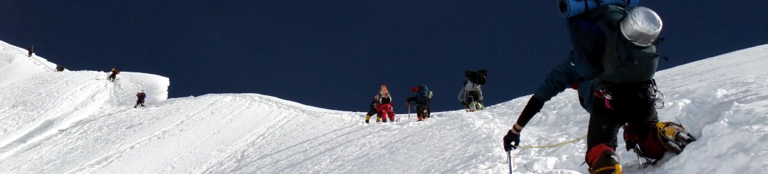
The terrain had been awful ever since leaving our tent, but now we were high on the mountaintops it became much easier. A phenomenon of many Scottish peaks is that trails can be non-existent down below, but comfortable as highways on top. I don’t know why this is, but trails also don’t have signposts like they would in continental Europe and I believe it may stem from antiquated beliefs in the hillwalking community that if you can’t bog hop across moorland with a map and compass then you shouldn’t be allowed on the hill.
As we powered up the hillside, Scotland threw its worst at us. The rain lashed down and the wind threatened to tear us off the mountain, but we kept going. At one point, I heard Edita cry out behind me. I looked behind and she was clinging to a rock on a narrower section of ridge as a more powerful gust tore against her. Her backpack was loose and an orange Sainsburys bag was billowing in the wind like a flag. I walked back down and helped her to secure the pack, but unbeknown to us, a sandwich had escaped from the bag.

Thankfully, this was only a brief passing gale that wasn’t to last. By the time we reached the summit of Sgurr Eilde Mor at one o’clock, the rain had blown away. The grey roof of Binnein Mor looked much more enticing, lying across the beautiful hanging corrie of Coire an Lochain with its patchwork of fish-shaped lakes.
Our traverse of this corrie was marred only by the discovery of Edita’s missing sandwich when we stopped for a snack beside the lake. We dropped steeply 250m from Sgurr Eilde Mor, then climbed 150m up an easy trail that zigzigged gently up an otherwise steep grassy hillside.
The three summits of Na Gruagaichean (1,056m), Binnein Mor (1,130m) and Sgurr Eilde Beag (956m, which is not a Munro) lie at the three tips of a three-pointed star, extending out from an unnamed 1062m summit at its centre. We joined the star beneath the summit of Sgurr Eilde Mor, walked up to the 1062m summit, then climbed Binnein Mor and Na Gruagaichean each in turn. It was classic Scottish ridge walking. The clouds were above every mountaintop except Ben Nevis to our north, which wore a slate-grey crown.
From Na Gruagaichean (a.k.a. Nae Grouchin’), we could look down on the village of Kinlochleven, where we started our journey the previous day on the shores of Loch Leven, and west to the peaks of the Ring of Steall, where I’d been enticed by these mountains a year earlier.

By the time we returned to Coire an Lochain, it was 5.30. We had one remaining Munro to climb, the tiny Binnein Beag which thrust up from the end of Binnein Mor’s steep north ridge like a big toe. It looked so close, and there were still three hours of daylight. But to reach it, we needed to drop 100m across another hanging valley and climb back up. The sky was gloomy again. Edita looked aghast when I asked if she still wanted to climb it. We agreed that it would be more enjoyable to climb it from a camp in Glen Nevis on another occasion.
It was a wise decision, for we needed every minute of those three hours to return to camp. We couldn’t find the trail marked on the map which skirted the northern side of Sgurr Eilde Mor. My instinct was to drop straight down the hillside and follow the valley floor back to camp. We were deterred by the knowledge that this way was exceedingly boggy. Instead, we ended up traversing a steep, heather-clad hillside for nearly 3km to rejoin our morning route at Meall Doire na h-Blah Blah Blah.
This was hard work for my weakened ankle and by the time we descended I was running out of energy and stumbling like a drunkard. Edita persuaded me to stop and eat an apple — the only remaining food that either of us were carrying. This had a remarkable effect, and we returned to camp without further delay, but the squelch-fest of a pathway down in the valley wasn’t easy to negotiate in the dimming light. My shoes took in more water than a sinking ship.
We reached our tent beside the copse of trees at 8.30, at the very last moment before it was necessary to produce head torches. We were happy with our tally of three peaks out of four. My ankle had held up, but I had been slow, especially during the descent. We had taken 11 hours, and if we wanted to climb the Grey Corries tomorrow, it was going to be another long day.
To be continued… and you can see all my photos from the trip here.


Love this. Thank you for posting.
Looking forward to reading part 4.
Amazing information. Sounds like it was a crazy interesting time. Was wondering if you had the GPS files for the adventure or is it all paper map done?
On this occasion I programmed the route into the Ordnance Survey app and used that to navigate. It does provide an option to download the GPX file, but we ended up varying the route slightly. I don’t carry paper maps any more.
It sounds like you may have had a lucky escape staying at Luibeilt – the abandoned bothy ruin is supposedly haunted! https://podcasts.apple.com/gb/podcast/uncanny/id1589938734?i=1000545677713