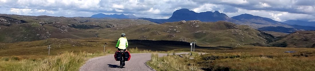

I was lucky to live and work for a year in Rome, where the highest peaks of the Apennines were accessible within a couple of hours. It was a hill walker’s paradise, with a feast of mountains of great variety, and reliable weather.
Had they been that close to London, those peaks would be crawling with walkers, but this 1,200km chain of mountains that forms the spine of Italy is undiscovered, despite being criss-crossed with hiking trails.
There isn’t much information available in English. We started our explorations with the excellent Cicerone guidebook Walking in Abruzzo, but good trekking maps are available (see below). Most trails are well marked with the red and white paint marks and signposts of the Italian Alpine Club (CAI). These things together mean that the peaks can be easily explored by experienced hikers.
In a series of posts I aim to provide a short introduction based on my own experience. It is inevitably focused on the Abruzzo and Lazio regions near Rome. The Apennines are amazing. I hope it will whet the appetite, and encourage some of you to explore this fantastic area.
This week I’m going to talk about Sirente-Velino, a massif of two halves within easy reach of Rome.
- Region: Abruzzo
- Paper map: Edizioni il Lupo 1:25,000 Velino – Sirente
- Principal peaks:
- Monte Velino (2,486m)
- Monte Cafornia (2,424m)
- Monte di Sevice (2,355m)
- Monte Sirente (2,348m)
- Monte Murolungo (2,184m)
- Monte Puzzillo (2,174m)
- Photo album: Sirente-Velino
Sirente-Velino has only regional park status, unlike its neighbours Gran Sasso, Maiella and Abruzzo, which are all national parks in the Italian region of Abruzzo. Don’t let this put you off though. Sirente-Velino is easily their equal in variety and beauty, featuring emerald-green paradise, bare moonlike landscapes and dramatic cliff faces.
Sirente-Velino Regional Park is named after its two principal peaks, Monte Velino (2,486m) and Monte Sirente (2,348m), which are separated by the high-altitude sanctuary of the Piano della Roche, home to the ski resort of Ovindoli. With the resort of Campo Felice (“happy field”) located on the northern side of the range, the area is more famous for skiing than hiking. But it’s easy to get away from the resorts and find yourself in a heavenly landscape for hill walking.
On the eastern side of the range, Monte Sirente is a long ridge of a mountain that slopes gently for 1,000m up grassy slopes from Piano della Roche, then plunges abruptly in a series of dramatic cliff faces on its north-east side. It’s a long slog up from the sanctuary, but from the north-east a route can be found between the cliffs after a long climb through forest.
On the western side of the range, Monte Velino rises above a more extensive cluster of peaks. Its twin summits of Monte Cafornia and Monte Velino are the most prominent mountains rising nearly 2,000m above Il Fucino, a vast plain to the south. This plateau lies at an altitude of only 650m, and was once the site of Italy’s third-largest lake, Lago Fucino. The lake was drained for agriculture in 1877.
On Monte Velino’s summit ridges, the land appears to be a barren grey moonscape, but thousands of hardy wild flowers provide little pinpoints of colour. In the summer, Monte Velino is best accessed from the Piano di Pezza, a quiet valley piercing into the heart of the range (as long as your vehicle is able to cope with the rutted dirt track). In the snows of winter this road, which rises to 1,535m, will be impassable.
In the summer months, the rolling peaks to the north of Monte Velino, centred around the long ridge of Monte Puzzillo, are an emerald paradise. Fringes of lush forest fill the valleys. Above them, the land is topped by grassy ridges that are dotted with ash-grey rock outcrops. The western-most peaks of Morrone (2,141m) and Murolungo (2,184m) are little more than an hour’s drive from Rome, and rise straight up from the main A24 highway from Rome to L’Aquila. Beyond the summits, in the middle of the range, the land is peaceful and it feels like you are miles from anywhere. Nestled within these peaks is the tiny lake of Lago della Duchessa.
The three main villages of the Piano della Roche – Rocca di Mezzo, Rovere and Ovindoli – all have accommodation set within a wide plain surrounded by mountains (although Ovindoli’s are dominated by the giant hotels of the ski resort, which are mostly empty outside the skiing season).
Down on the plains to the south is the town of Celano and its square, turreted castle ringed by red-roofed houses. Rising directly above the town is the striking peak of Serra di Celano (1,921m), known locally as Monte Tino. This is very much a mountain of two halves. From the much lower altitude of Celano, it appears to be an enormous grassy pyramid. It’s an easy – if long – walk up in full view of the town, with everyone watching you. Just beneath the summit is a sizeable, cosy cave, with a couple of small rooms completely shielded from the elements. If you’re into that sort of thing, you can take a sleeping bag, mat and stove, and spend the night up there.
From the higher altitude of the Piano della Roche on the north side, Serra di Celano looks much smaller, but its serrated profile of jagged cliffs turns it into a rock climb.
Sirente-Velino also has a hidden treasure on its south side. The Celano Gorge cuts all the way up from Il Fucino to Piano della Roche between the forested crags of Serra di Celano and two outlying peaks of Monte Sirente. In places the gorge is only 5m wide, squeezing between cliff faces hundreds of metres high. In the winter, the gorge is inaccessible as snow from the mountains melts in torrents and crashes down through the gap.
In the summer the gorge is completely dry, and a nice walk with a Middle-Earth feel. If you walk up from a car park on the south side, you won’t hear a trickle of water until, as if by magic, a waterfall called the Fonte degli Innamorati spills down from the rocks above. Where this water comes from and where it goes to is a mystery I wasn’t able to resolve. If you keep going up to the Piano della Roche, you will find an old shepherd’s hut that has been converted into a café.
For the first timer
An ascent of Monte Sirente is a good place to start. Park your car at the Chalet Sirente, beneath the cliffs on the north-east side, and climb through the forest until you reach the wending path that cuts an improbable route through the cliffs to the summit escarpment. In the winter this trail will be invisible under snow; you will need to improvise a route and be confident with ice axe and crampons.
For the beginner
Serra di Celano is an easy hike up from the town of Celano with long views across Il Fucino to the south, and the peaks of Abruzzo National Park. On the summit, the view suddenly changes as you find yourself gazing down into the pleasant high-altitude sanctuary of the Piano della Roche, surrounded by mountains. Spend some time up there by traversing the mountain’s long summit ridge.
Meanwhile on the northern side, Monte Orsello (2,043m) is an easy ridge to walk along from the road through Campo Felice. All along its length are grand views of the Gran Sasso range immediately to the north.
For the adventurous
An ascent of Monte Velino from the Piano di Pezza takes you into the heart of the range, where a network of linked ridges provides a number of options for extended hiking over many summits. If you have more than a day then you can spend a night up there, either on the shores of Lago della Duchessa or, if it’s open, at the mountain hut of Rifugio Sebastiani.
Photos


You can see a few hundred more photos of Sirente-Velino Regional Park in my Sirente-Velino Flickr album.
Blog posts
I’ve written several blog posts about our adventures in the Apennines. These will give you a bit more detail and a few more ideas on places to explore.
- Trailblazing up Monte Sirente. Our first visit to the park was in a snowy March. Finding a route up through the cliffs of Monte Sirente was challenging, but ultimately very rewarding, and we made some friends.
- The Corno Grande aperitivo: highest mountain in the Apennines. Don’t be misled by the title of this post, which refers to an ascent in the neighbouring range of Gran Sasso. After climbing Corno Grande we spent three days in the Sirente-Velino range, climbing Montes Velino and Sirente, and hiking up the Celano Gorge.
- The Lithuanian conquest of the Apennines. We were determined to make another ascent of Monte Sirente from the north-east side, to discover the path that we lost during our first attempt in winter. So we returned again one summer with Edita’s family.


