
I made my first close acquaintance with Cotopaxi, Ecuador’s highest active volcano, when we climbed Rumiñahui, an attractive peak of three rocky summits a stone’s throw to the north-west.
There is a clear avenue of volcanoes as you drive south from Quito. Pichincha, Atacatzo, Corazón and the Ilinizas rise in a line to the right of the Pan-American Highway, while Sincholagua, Pasochoa and Rumiñahui form a protective shield to the left. Behind these mountains the high grasslands of Antisana and Cotopaxi hide.

Whymper described these peaks as ‘hilly rather than mountainous’, and considered the smallest of them to be beneath contempt because you can ride a donkey to the top.
It’s maybe the riding of the donkey that’s contemptible though (it’s cheating, surely). If these mountains were to be planted in Scotland, hill walkers would drool over them and come in their thousands every year. The ridge scrambles up to summits would be considered classics, while rock climbers would find any number of climbing routes ranging from SF (I’m not super good on climbing grades, but I think this means ‘severely facile’) all the way up to F Diff (I can’t give you the literal translation as I’m too polite, but it roughly means extremely difficult).
We took the road as far as the town of Machachi, where we turned left up a cobbled track between Pasochoa and Rumiñahui. The 19th-century British mountaineer Edward Whymper spent several weeks in Machachi in 1880 as he explored the surrounding volcanoes. During his stay he made first ascents of Corazón and Sincholagua, climbed Cotopaxi, and reconnoitred the slopes of Iliniza Sur. Machachi is now a sprawl of half-built houses on grid-patterned streets, and we passed through quickly.
Cotopaxi disappeared briefly behind Rumiñahui, but we soon had unobscured views when we rounded Rumiñahui’s north peak and looked across the Limpiopungo Plain. The road had climbed to 3,000m, and we reached the park entrance.
Alexander von Humboldt, who visited in 1802, described Cotopaxi as ‘the most beautiful and the most regular of all the colossal peaks of the upper Andes’. A more quintessential view of a volcano would be hard to find. We were due north of the mountain. A dirt road led across a wide, grassy plateau towards a perfect cone framed under clear blue sky.

Cotopaxi’s gently tapering lower slopes were a sea of brown ash, featureless but for a number of gullies where you could imagine its terrible lahars had once flown. These are devastating rivers of mud, rock and ice that follow a volcanic eruption and sweep away everything in their path.
About 4,500 years ago, a lahar formed on Cotopaxi’s northern slopes that was so big that it has left its mark on the landscape ever since. Scientists have estimated that it discharged its debris at a rate of up to six million cubic metres per second. It ripped across the Limpiopungo Plain, directly north of Cotopaxi, and diverted either side of Pasochoa, a 4,201m volcano rising above the southern end of Quito. Then it raced across the area now occupied by the towns of Cumbaya and Tumbaco, close to Quito’s international airport (which mercifully didn’t exist in those days, or flights would have had difficulty landing).
In total distance, the lahar travelled over 300km to the north-west, ending up in the Pacific Ocean, and 130km east into the Amazon basin.
Evidence of this monumental event can still be seen clearly today. In the Chillos Valley, 40km downstream from Cotopaxi, depths of up 160m have been observed in the existing rock. As we looked up at the slopes of Cotopaxi, one especially deep gully may have been formed by this very event.
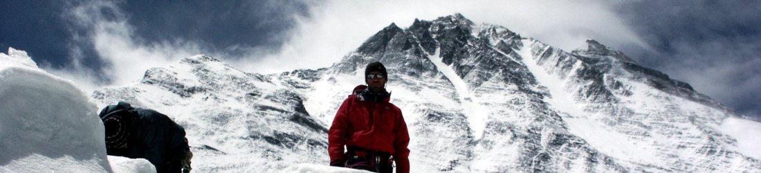
The top third of Cotopaxi was a continuous sheet of ice, apart from a single dry spot at 5,500m, just below the summit, where a sheer cliff broke through the glacier. This black rock was the outer wall of the crater and was known as the Yanasacha Wall. There were ice cliffs directly above it that I hoped we wouldn’t have to climb. On the eastern side the ice was a crumpled mass of seracs and crevasses, but on the north-west part the ice was smoother and looked like it would be a safer climbing route.

Between the park gate and the volcano, the wide expanse of the Limpiopungo Plain was sparsely vegetated, but there was enough to feed the herds of wild horses who clustered freely. Most eye-catching, though, were the giant boulders that littered the plain, some tiny, the size of fists, but others towering like houses. It was easy to imagine where they came from. These were the bombs of volcanic rock that Cotopaxi had fired out during eruptions.
Our objective for that day was Rumiñahui, an extinct volcano 14km to the north-west of Cotopaxi. Rumiñahui the mountain is named after Rumiñahui the Inca warrior, one of the generals of Atahualpa, the Inca emperor who was imprisoned and executed by Spanish conquistadors in 1533.
Rumiñahui was in the process of delivering a huge ransom of gold and silver artefacts to the Spanish when he learned of Atahualpa’s death. Legend has it that he returned to Quito, gathered even more treasure together, and threw it all in a lake somewhere in the Llanganates mountain range south-east of Cotopaxi, to prevent the conquistadors from getting their grubby hands on it.
Rumiñahui was eventually defeated and captured at the Battle of Chimborazo. Despite being tortured to death by his captors, he never revealed the location of the treasure, and if it ever existed then it may still be out there somewhere. Those who have gone looking for it in the centuries since include the Lancastrian and Scottish mountaineers Joe Brown and Hamish MacInnes, who made three expeditions to the Llanganates in the 1980s. Intrepid as these expeditions were, I’m told it’s not the furthest a Scotsman has travelled looking for money.

The name Rumiñahui translates as ‘stone face’, which is as appropriate a name as any to give this particular mountain. Viewed from the east, its three summits — south, central and north — form the shape of a letter ‘W’, with two serrated ridges linking them all together. At 4,712m the north peak is the highest, and its 4,692m south peak the most technical. We were aiming for the central summit, which at 4,634m was the smallest of the three, and also the easiest to get up — a walk and a short scramble.
It was a straightforward ascent. We parked beside a small lake, Laguna Limpiopungo, and ascended rolling hillsides of thick paja grass to reach the base of the mountain. If Quito felt ever-present during our ascent of Rucu Pichincha the previous day, I now felt like I was in the Andean páramo for real. The grass was so tall I could have dropped my wallet and spent hours looking for it. No wonder Rumiñahui’s treasure has never been found.
Apart from our vehicle parked beside the lake, there was not another sign of civilisation anywhere in view. The grass was thick, sometimes as high as our shoulders, and the trail was only faint. It felt like few people had come this way before us.
As we climbed higher into the páramo the hills became alive with purple lupins and the orange flames of chuquiragua. Gradually the trail joined a gentle ridge that became a projecting spur of Rumiñahui Central. The spur was a steep buttress that would be a technical rock climb, but the trail diverted to the right of it, and zigzagged up to the summit by way of a gully on steep scree. We reached the summit at 2.15 after a short but straightforward scramble.
It was a much smaller summit than Rucu Pichincha, the mountain above Quito that we had climbed the previous day. We crowded onto it and surveyed the scene.

We were right in the middle of the Avenue of the Volcanoes. The Ilinizas, Corazón, Atacatzo and Pichincha formed the skyline to the west. Behind them the Andes dropped away to the Pacific. On that side it was very much a landscape of civilisation, with farms and villages in the valley below us. The eastern landscape, across the wild páramo, formed a marked contrast. The black dragon-back of Sincholagua, with two sharp fins, was free of cloud. Part of Antisana’s snowcap was visible behind it, but the mountain was mainly in cloud.
Cotopaxi was by far the closest and most dominant mountain from Rumiñahui. Its summit was now hidden by an evil black cloud, but tongues of glacier spilled beneath. It looked nasty today, but we could see that the summit route was not too steep.
It was a view that I would have liked to spend longer savouring, but every mountain sat underneath a dark grey ceiling of cloud that looked like it would burst at any moment. In short, we needed to retreat as quickly as possible, and spent no more than ten minutes on top. We got off more lightly than we were expecting. There was a short, sharp hailstorm, and we stopped to put on Gore-Tex jackets. Before we had even reached the páramo again, the storm ended and the clouds parted a little. It was enough to see that in just a few minutes the summit of Sincholagua was dusted in white. But we saw no more of Cotopaxi that day.
This is one of the extracts I edited out of my forthcoming book about a cycling and climbing adventure from sea level to the summit of Chimborazo. There weren’t enough jokes in this passage, but I’ve reproduced it here as some of you may still find it interesting. The finished book will be available sometime next year.


I’d be interested to learn of any reliable experienced guiding companies that operate in the area. Sounds like a great time and one worth exploring more…..All your posts are such wonderful reading. and this one is no exception.
I happened on you while investigating what ruminanhui meant (jacket for sale with the name)
I loved reading your blog-was in Ecuador recently and just loved the visit. I physically cannot hike or climb, but I enjoyed thru you. Thank you-especially the beautiful photos!