
I have a large coffee table book on my bookshelf called Trekking Beyond: Walk the World’s Epic Trails. Yes, I know what you’re thinking – why is it on my bookshelf, not on my coffee table? I don’t have an answer to that question, but I can tell you that it has this to say about the Tour du Mont Blanc (TMB):
More impressive [than its 170km] are the 10,000m of cumulative ascent… Without requiring technical skills, crampons or a down-suit to fend off the biting cold, Mont Blanc trekkers cover more cumulative metres of altitude than Everest climbers.
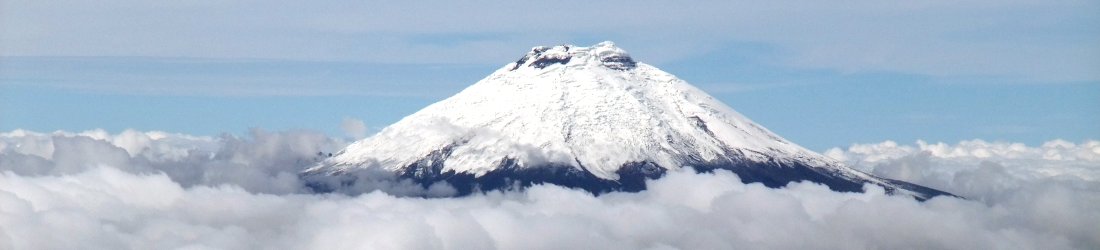
You may know that I have an unusual itch that I can’t help scratching when somebody compares metres ascended vertically with climbing Everest, whether it involves the stairs in your house, a short stretch of hillside that you’ve pedalled up and down repeatedly on a bike, or a few passes on a long-distance trail. This is because you don’t actually ascend the full 8848 on Everest. Base camps on both sides of the mountain are situated at around 5,500m and you can actually drive to one of them. What makes the metres stand out on Everest is that you ascend them in a part of the planet much closer to outer space. This means that there isn’t much oxygen to breathe. The 10,000m of the Tour du Mont Blanc aren’t really comparable to the ones on Everest unless you hike them in a gimp mask, as well as a down-suit and crampons.
The three authors of the book – Damian Hall, Dave Costello and Billi Bierling – are arguably better known for other things than writing inspirational coffee table books. It doesn’t surprise me at all that the ultra runner Damian Hall, who has literally run around the TMB in 22 hours, thinks that climbing Everest is a piece of piss (though how he saw enough of the TMB to remember what it’s like is another question). Nor does it surprise me that Dave Costello, who as you know, wrote the hit song Oliver’s Armies, understands the difference between trekking and high-altitude mountaineering. But Billi Bierling, keeper of the Himalayan Database, heiress to the legacy of the great chronicler Elizabeth Hawley, who has herself climbed six 8,000m peaks including Everest (Billi, not Ms Hawley) should know better. I can only conclude that she couldn’t catch Damian when he ran to the publisher with his edits.
Anyway, I’m rambling (if you’ll forgive the pun). I’ll get to the point.
More sensibly, the authors of Trekking Beyond go on to describe how the TMB ‘navigates you through three countries – each with a distinct feel’. I’m in the process of editing my video footage of Edita and my own trek round the TMB in September 2024. We didn’t wear down suits (though it would have made the footage more entertaining), but we did feel that change in vibe as we crossed a high pass into a different country.
To account for this, I’ve edited the videos into sections, each ending at a border. I’ve completed the first two videos, the first of the French section from Chamonix, and the second of the Italian section through Courmayeur. There are 28 minutes of footage in total. In a later blog post I will complete the set with the Swiss section and final French section back to Chamonix.
You can watch the whole thing in one go here. You can also see all my still photos from the trip here, and read the trip reports for France and Italy here.
Tour du Mont Blanc (TMB): Chamonix to Col de la Seigne
Our Tour du Mont Blanc started with a cable car journey high above the Chamonix Valley to the ski resort of Planpraz. It was mid-September, but already there was snow on the slopes above as we climbed up to the 2,525m peak of Le Brévent via Col du Brévent. Here we joined crowds of tourists who had continued in the cable car up from Chamonix.
The snow cover was temporary. It petered out as we descended through forest to the village of Les Houches, the traditional starting point of the TMB. We only encountered it again briefly two days later.
We had a gentle day ambling along woodland trails and through sleepy villages in the Val Montjoie, before a big day crossing three high passes: the Col du Bonhomme (2,329m), the Col de la Croix du Bonhomme (2,479m) and the Col des Fours (2,665m). Here we reached the high point of the trek when we climbed up an easy peak Tête Nord des Fours (2,756m), a classic Mont Blanc viewpoint.
On the fourth day of the trek we walked up the Vallée des Glaciers to Col de la Seigne, which marks the border between France and Italy.
Tour du Mont Blanc (TMB): Col de la Seigne to the Grand Col Ferret
We entered Italy for the first time in five years on foot via the 2,516m Col de la Seigne during our fourth day on the Tour du Mont Blanc. We descended the picturesque Val Veny, with the outlying pinnacles of the Mont Blanc massif walling the valley to our left. The second half of a long day involved a big climb up to an elevated trail high above the valley, before descending through the ski resorts to Courmayeur for the night.
On the following day Edita talked me into taking the high route above the Italian Val Ferret along the ridge of Mont de la Saxe and up and over 2,584m Tête de la Tronche. The clouds lifted during this section and we had splendid views of the more technically difficult Italian side of Mont Blanc.
We had a taxi booked to take us back from Arpnouvaz to Courmayeur for the evening, so we took this section at a rapid pace that I found quite exhausting.
We resumed our trek up the Val Ferret from Arpnouvaz the following morning and climbed past a herd of mean-looking cattle to the 2,537m Grand Col Ferret. Here we crossed into Switzerland after a brief two-day sojourn through the Italian Alps.


I have done Everest Base Camp (age 63) Annapurna Base Camp(65)
Machu Picchu via Salkantay (64) and TMB (66) with EBC being my first multi day hike after nine months ‘training’ on the Bruce Trailin Ontario.
I did TMB in July and there was still some snow at the higher elevations but the beauty was that all the alpine flowers were out and it was truly beautiful. One of our group ‘Big Dave’ (6’.4” at least) said he always wanted to do a ‘the Sound of Music scene so he did and ran though a meadow sing ‘The hills are alive with the sound of music’ something I will never forget.
Truly a great hike with the luxury of B&B and snow great mountain huts. I would recommend it to anyone and especially as a first long distance hike. Thanks for your story